
Days 8 & 9: Cape Brett Track
adventurecampervanlifefaunaholidayNZNZ Placeswalks
Day 7 was a transition day. We drove out of Horeke past the site of the bushfire where the smell of burning is still strong and firefighters are still up there damping down and checking hotspots we presume on the blackened hillside. If this is the aftermath on a very small bit of land we can only imagine in horror and disbelief what Australia will face when (if) the fires over there are ever brought under control.

Then it was on to Waitangi, book into the campsite, get provisions for the next few days and pack. We called in at the i-Site in Paihia to get our track passes and book into the Cape Brett Hut. We had tried to do it online from our phones but internet access had been intermittent and the website had been troublesome as a result so it made more sense to do it in person. The guy in the i-Site also struggled and it took a few goes to get through to be able to book the track permit. It turns out on a closer inspection of the documentation we were given and after an email we received this morning, that we are actually booked in for this weekend not last weekend so there clearly are issues with the system!
The first part of the Cape Brett track from Rawhiti to the Deepwater Cove junction is on privately owned land and a fee is levied ($40 per person) to help pay for maintenance of the track. From then on it is on Department of Conservation land. DoC administer the booking process for the track through their booking system. It appears though that not everyone bothers to pay the fee (maybe they don’t also pay for the hut?) There are also complexities to the system in that you can walk from Whakamumu which is a DoC track and join the Cape Brett track where it is still on private land. You could also start from Deepwater Cove, walk to the hut and then walk all the way back out to Rawhiti crossing the private land. You can also be dropped off by water taxi at Cape Brett and walk back to Rawhiti. In theory all these options require you to buy a track permit, in practice, how many do? Margaret who runs the campsite at Kaingahoa Marae and whose iwi own the land the Cape Brett track is on was telling us that there is talk of taking back management of the permit system in the next few years. The track will officially start at the marae, there will be information boards about the history of the land and what the fee is used for and walkers will check in there and pay before they go.
We still had plenty of daylight left and decided to take a wander up to the Manawa Groves on the way up to Haruru Falls. We totally misremembered how far it was an ended up walking 10km in jandals – probably not the best preparation for a big walk tomorrow!!
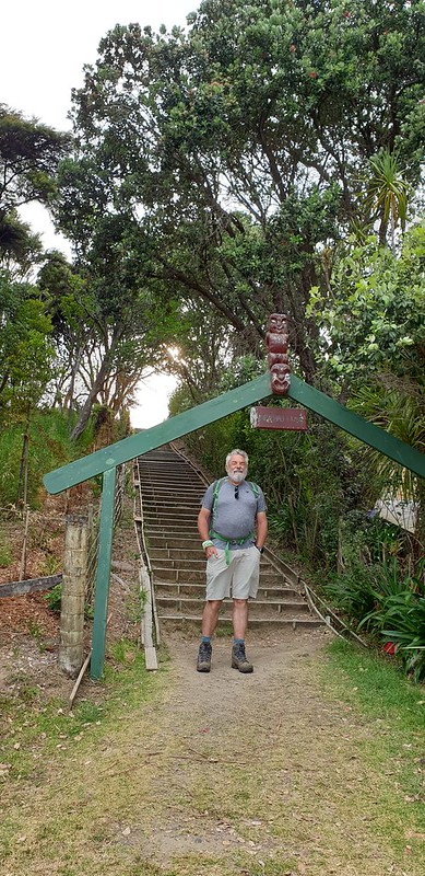
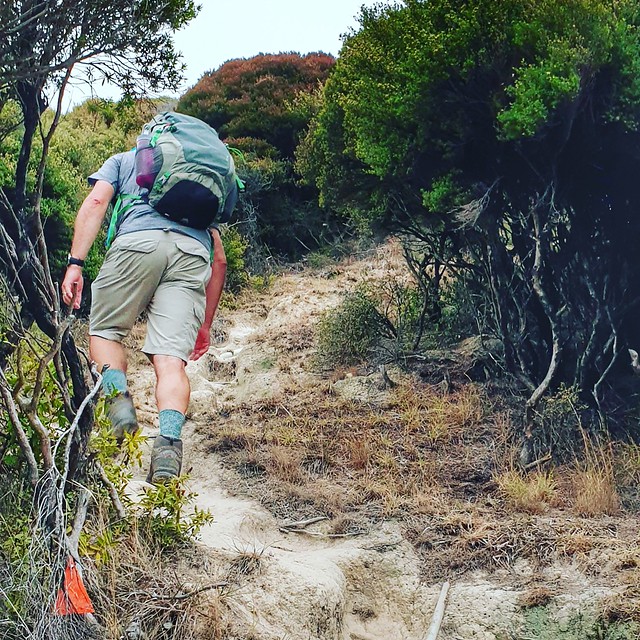
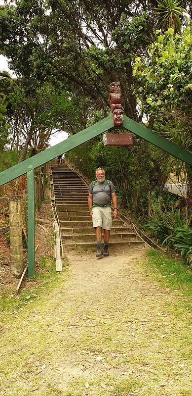
We were up and ready to rumble by 5.45am to drive round to Opua and get the 6.30am ferry. It’s a 40 minute drive over to Rawhiti where we parked up at Julie’s parking spot next to the Kaingahoa Marae camping ground for $10 for secure parking for the two days. We found out later that the land was not Julie’s but she manages it for the whanau who owned the land. One of the lads, Zane, who was up at the hut with us is part of the whanau but has only recently rediscovered his roots in Rawhiti after being brought up in Hawkes Bay.

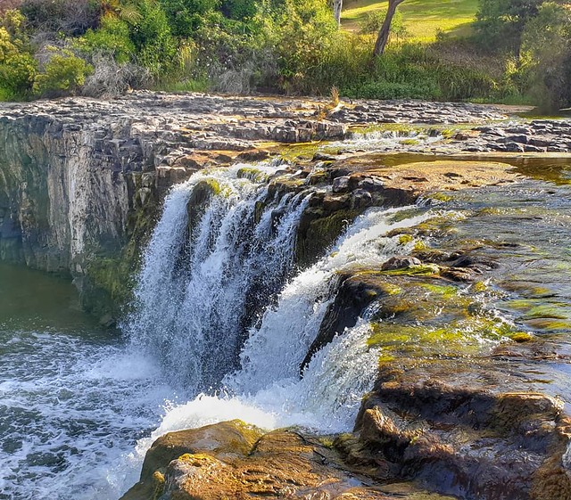
What can we say about the Cape Brett track? All superlatives! Stunning views, incredible experience, 2,300m of ascent over 32kms (except that it is nearer 35kms!) Demanding, strenuous, rewarding, relentless ups and downs!
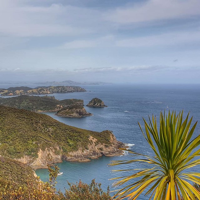
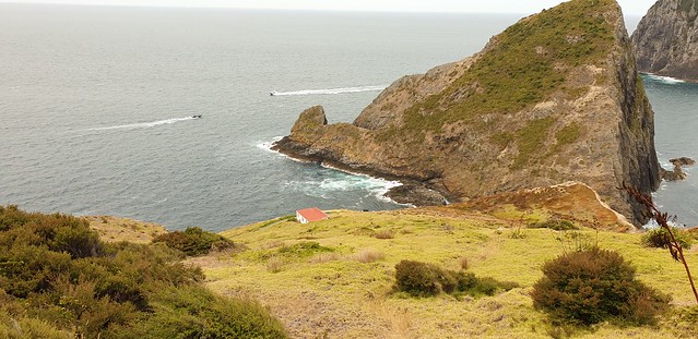
The first 2km is just up – easy trail but it ascends from sea level to 345m over 2km so it is steep! There is a shelter at the summit of Pukehuia and an information board that tells that Pukehuia literally means hill of the huia bird but that this is representative of the gathering of chiefs from the 7 waka of the Great Migration fleet. Pukehuia is one of the 7 peaks along the peninsula and each peak represents one of the waka. Rakaumangamanga is the first at Cape Brett itself and is the branching of the canoes. From Pukehuia there is a beautiful view down to Rawhiti Bay and beyond.

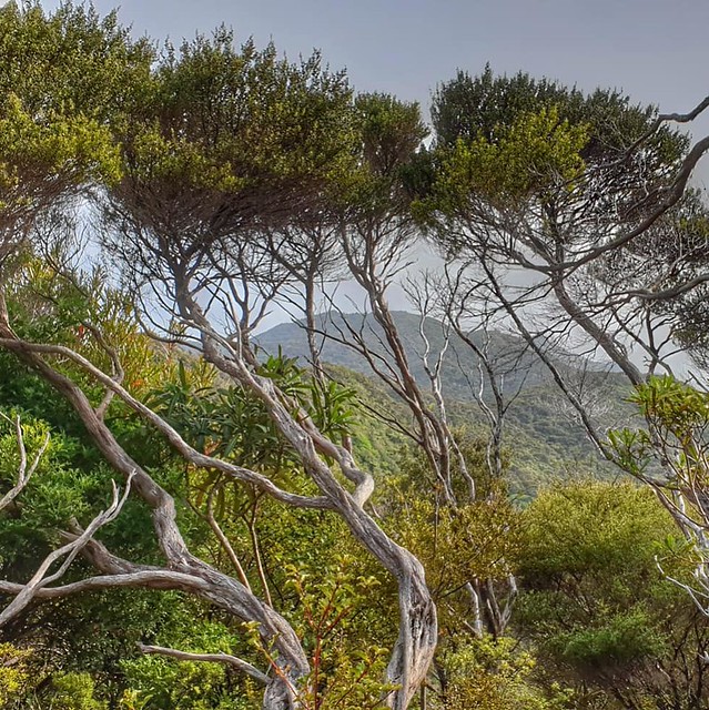
The track continues on down steadily for a while through forest and whilst it is still early the heat of the sun is starting to break through and it is nice to be in the cool shade of the trees. There are steep sections of down followed by steep sections of up and also some steadily rising flattish sections along the ridge where there are views out to the ocean and the crinkly coastline that juts in and out. Blue, blue water turns to white as it crashes against the rocks. The birds are starting to sing – Tūī, Bellbirds, Miromiro, Pīwakawaka and others I can’t identify. And then amongst the birdsong, there… the shrill but heart-warming sound of the cicadas.

We reach the ‘Rabbit Proof Fence’ – a pest control fence at about 4.5km in – a description we read suggested that this was a third of the way to the lighthouse. It is not true. Not even mathematically if the track really was 16km (which it isn’t!) and very definitely not in terms of time and effort. We have been going about an hour and three quarters by now and decide that we will aim to get to 8km before we stop for ‘second breakfast’. The going has been fairly straightforward, plenty of climbs but not unduly hard underfoot. An hour later we find a sunny spot at the top of a hill where there is a space off the track in the shade of the Kanuka trees to sit down and have our picnic. We haven’t quite got to 8km but it looks like 8km will be at the bottom of a hill in the thick of the forest so this is a good bet.

A couple come past us going the opposite direction; they left Cape Brett hut at 7am and tell us that the second half of the walk is much more rugged and demanding. A single walker goes past us as we eat – we spend the next few hours playing leapfrog with him as we each walk and take breaks at different points. He hasn’t booked into the hut and when it appears to get busy later on he sets off back to walk the return trip in the same day.
We are getting used to the ups and downs now – what goes up must come down and vice versa. At least there is variation and the downs provide a sort of respite from the effort of climbing up! But the views, sometimes just glimpses through vegetation windows, sometimes full-blown, take your breath away. Vistas of amazingness make it all worthwhile.
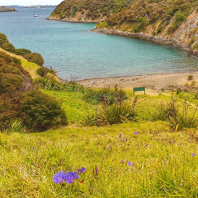
The Deepwater Cove junction comes upon us sooner than we thought. We have been going for about 4 hours and we are more than three-quarters of the way according to the km markers. We head down the 700m that will take us to the cove where we have lunch and I have a swim. I have been looking forward to getting in the water but there is a chill breeze, and whilst it is a pleasant spot, as our companion noted, Deepwater Cove isn’t an overwhelmingly attractive cove. There are many more that are much more picturesque and inviting. Nevertheless, I am here and I will swim! Once I ventured in, tiptoeing over the pebbly beach strewn with clear, almost invisible jellyfish, it was quite refreshing and I spent 5 minutes or so swimming across the bay and back again.
Back up the hill and we have only 4km to go according to the markers. But the sign says 5km and 2 and a half hours. Hmm! Surely it can’t take us that long to do 5km?!

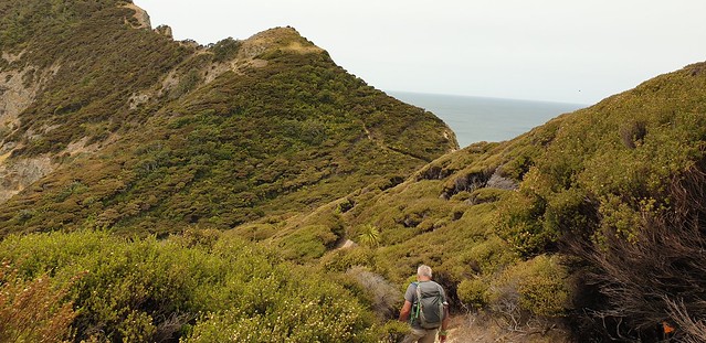
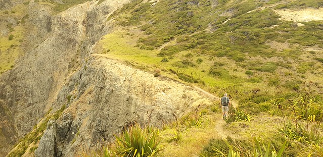
It is indeed much more challenging than the first section of trail. The ups are more up and the downs are more down. The ground underfoot is very rugged, rooty and loose and going down takes as long if not longer than going up. But the views are getting even better than before. As the trees thin out, and as we cross the peninsula and climb the ridge, steep drops to the side of us down impressive cliffs, we have panoramic views of the ocean and we can look back along the peninsula from whence we have come.
The last 2km are excruciatingly slow. The wind has picked up and we are literally putting one foot in front of the other. From Deepwater Cove onwards I have stayed with Nigel – before that I trotted on ahead and waited for him or went back to meet him. He is tired and his legs are sore but he battles on! What a trooper – I certainly test him with my adventures and he always responds.

As we cross the headland and can see out towards the end, it is very clear that there will be more than the 1km to go that the 15km marker might suggest. Sure enough, as we climb the last hill (Rākaumangamanga) and reach the top there is a 16km marker with small writing underneath that says ‘approx 1.2km to the hut’. Seriously!

We can now see the lighthouse and the hut down below it. The path snakes its way down, zigzagging along the contours.

Finally, we enter the hut seven and a half hours after we set off. It’s good to sit down!
That would be it for today – there is little point talking about all the usual happenings in a mountain hut; jostling for the ‘best bed’ – wondering who we might disturb with Nigel’s snoring or who might disturb us; discovering that there is just a dribble of water from the outside tap and none from any of the inside taps; working out how to switch the gas on; boiling water for drinking the next day; Nigel falling asleep almost immediately; chatting to new arrivals as they stagger into the hut in various stages of pain, exhaustion and relief!
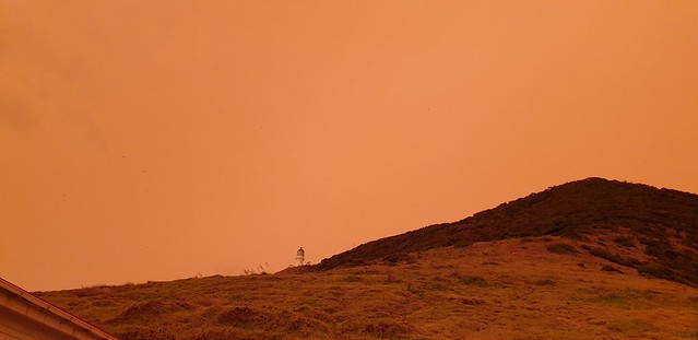
But what is worth describing is the amazing light we witnessed during the evening. Surprisingly, we had very good mobile phone reception at the hut and had seen and read posts from people in Auckland about the orange sky. There was even a news report that Aucklanders had inundated the police with 111 calls, thinking that some catastrophe had occurred! Well, there was a catastrophe; the bushfires in Australia and the orange sky was a result of the smoke filtering and blocking sunlight.


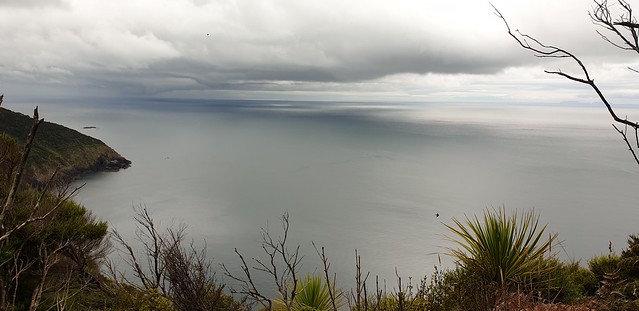
At Cape Brett, the sky went a strange shade of gloomy yellow to start with, the sun was a pale pink colour and it seemed quite dark. There are no lights at the hut and we needed torches to cook our tea inside. I had ventured down the stairs to the jetty to explore – the history of the lighthouse is interesting and there is an old railway track that was used to winch supplies into the small community that lived here. It is now mostly home to the seagulls who nest just below the hut – it’s a bit smelly and very noisy! It was rather unnerving as the birds shrieked and swooped around, some clearly protecting nests and I was a little nervous of being attacked!
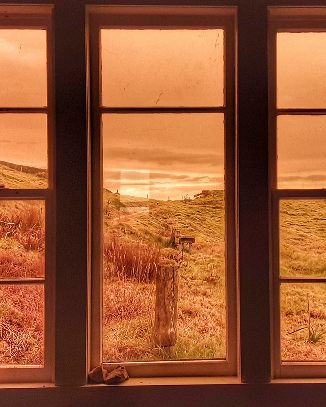
We could see across the sky – to the west the sky was quite yellow, but to the east it was clear. You can see in the photo below a line in the sky where it starts to lighten.

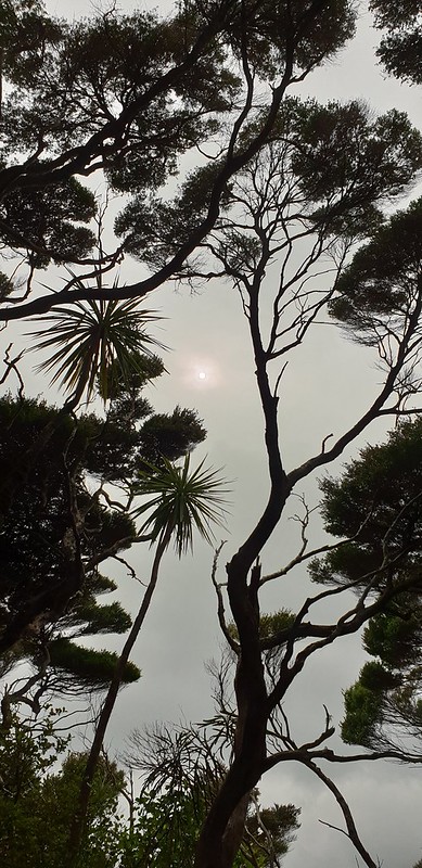
Then the sky started to darken even more and turn orange and spread more across the sky. The two photos below are looking up towards the lighthouse which is more to the east. They were taken a few minutes apart and you can see how the light has changed.

It started to get cold and feel like night was setting in but it was only 6.30pm! We retreated inside and watched through the windows as the light changed. The part of the kitchen facing east was much brighter! This photo is taken from the window facing west.
Part 2: The Return Journey

We slept well and late – didn’t rise until 7.30am. Legs a little creaky but it didn’t take long to crank them into gear and start the climb up from the hut to the summit of Rakaumangamanga. Slow and steady was the order of the day. We did feel a little daunted about the climbs ahead after the first day but also felt a bit proud that here were we, two ‘old’ people up and walking out when the majority of the youngsters at the hut had opted to pay $50 a head to get the water taxi out!
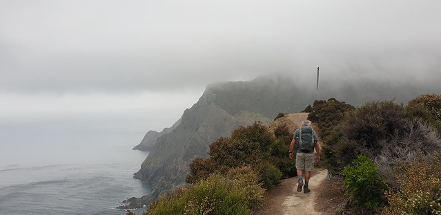

It was much windier and cloudier than yesterday and I was a tad nervous about the strength of the wind at the point where we cross the peninsula – a hefty gust could lift you off your feet and down off the cliff. However, the wind seemed not too bad at that point and as we walked back the cloud lifted and we walked into sunshine.
One of the young men had tried to convince himself when deciding on the water taxi that there was little point walking out as he had seen all the views on the way in. A different day brings different weather and different views! The light across the ocean with dark clouds was beautiful.
We were making a good pace and decided to stop for something to eat at the top of the cliff at around the 9km to go mark. The rugged stuff was under our belts and whilst there was still plenty of climbing to do, it was gentler and we knew that the last 3km was all downhill! It was hot though, the wind seemed to have dropped at least in the shelter of the bush and the humidity was high! Plenty of water stops!


As the sun came out, so did the birds and the cicadas and we were surrounded by the noise of the bush. It was lovely. Miromiro flitted about – difficult to get a photo but you can just about see this one!

The top of Pukehuia – all the climbing is now done and all we have to do is negotiate the dry, sand, gravelly downhill on tired legs!


1 Comment