
Adventures in Aotearoa: Ruapehu
Uncategorized

Another weekend looking for a weather window. Ruapehu looked good, if a little windy. We decided to get away late Friday afternoon and walk into Blyth Hut, walk on to Rangipō the next day, stay there overnight and then walk out on Sunday. Sunday would be a long day, but the weather looked good.
That was Plan A. We ended up doing Plan B.
Friday Evening
The walk into Blyth Hut is relatively short but pretty. The first section is on easy trail through Beech and Kaikawa (Mountain Cedar) forest. It emerges into an alpine wetland area where we followed an elevated boardwalk. We stopped briefly to look at the reflections of a cloud-shrouded Ruapehu in the wind-rippled Rotokawa pools.

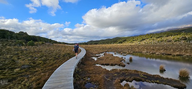
The boardwalk then descends steps to Waitonga Falls. At 39 metres, it is Tongariro National Park’s highest waterfall, formed by water carving a path through the volcanic landscape of Mount Ruapehu. We crossed the river at the bottom and then carried on up through the forest to the junction to Blyth Hut.

The signpost said 30 minutes to Blyth Hut. The first part winds steadily up through the Beech forest before coming out on more open, rocky ground. A large boulder perches on the edge of the slope with views down the valley.


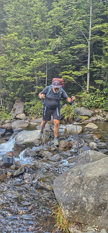
Our route took us to the left, rock-hopping along the trail that followed the river. We arrived first at Lupton Hut – a private hut owned by Wanganui School, then crossed the river and up a zigzag track across a boulder field, up some steps and into the clearing of Blyth Hut.

It was a beautiful evening, the hut was quite full, so we found ourselves a bunk, made dinner and then sat with the other dwellers to watch the sun go down.


Saturday
Saturday dawned as a beautiful day. We wanted to get a reasonably early start as we knew we had around 15km to walk to get to Rangipō. The plan was to get to Mangaehuehu, stop for lunch and then carry on the 8.5km from there.

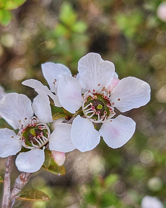
The first section is a steady climb through Beech forest and full flowering Mānuka, which was stunning. The photo really doesn’t do it justice.
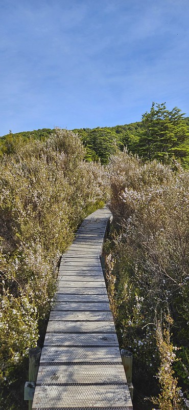
We emerged into alpine tussock along a path that today was relatively dry, caked mud, but I have known to be wet and greasy. Interpersed there are bits of annoying boardwalk that have a wide gap, so your toes get caught between the lats! However, the views down to the valley and up to Ruapehu made up for the awkward terrain.

It was at this point that I noticed that Nigel seemed to be slowing down. I was in the front getting my stride on and hadn’t really noticed how far behind he was. It gave me a chance to take photos and look around me more closely. As we had seen last week on Taranaki, there were plenty of mountain daisies, eyebrights, hebe and heather (an invasive species which tends to smother natives, so there is a programme of eradication going on using the Heather Beetle), and of course, the golden red of the tussock grass.

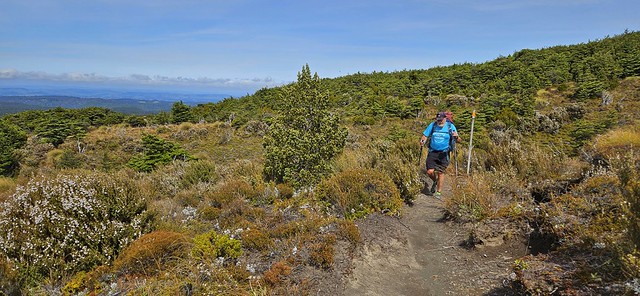
When I got to Mangaehuehu Hut, there was a group of 4 walkers also just arriving from the other direction. I had a bit of a chat with them, consulted the map, checked the distance and waited for Nigel. It is a small hut, and the 4 of them took up most of the space inside. Despite the sunshine, the stiff breeze made it a wee bit cold to sit outside, so we decided once Nigel arrived and had a bit of a rest that we would carry on up the track to find a sheltered picnic spot. If truth were told, the 4 young men were a little bit smelly too! The first part from the hut took us back into the beautiful Beech forest, I love walking through it – the dappled light, lovely and soft underfoot and the sound of the wind blowing the trees.

Just over a kilometre further on, I found a wee stream that seemed like a perfect spot for lunch. I was surprised again at how long after me it took Nigel to get there. He is normally behind me, but not by much.

Onwards through the last bit of bush and out into the desert. This is my happy place. I love the open wilderness feel – big sky above, vast terrain in front and all around. But the wind! Oooph! It hit us as we came up and out into the open. The ground underfoot is rocky, and the path is not really unclear, but you do have to pick your route across the rocks, so it isn’t easy walking.

I waited for Nigel to catch me up, and again, he seemed to be labouring. I carried on, but then decided that he may need some help. I found a place to stash my backpack and went back to him. 400m back, I met him, took his pack off him, and we retraced my steps to where I had stashed my bag. We did this 2 or 3 more times – each time I would walk on for a km, then go back 400m, take his pack and go back to my backpack.

The wind was quite strong now; a couple of times, I was blown sideways, my poles were taken from under me and once I actually lost my feet and staggered to stay upright. After we had gone about 4km from the hut, we checked the map. It still seemed to be another 6km at least before we would reach Rangipō, despite the information on the DoC site saying it was only 8.5km. It was time to make a decision.


I can’t remember what time it was, but at the speed we were going, it looked like another 2 – 3 hours at least to get to the hut. We also still had a lot of climbing to do as the path trended uphill to Rangipō Hut, which is the highest hut on the Round the Mountain track at 1600m. In and of itself, that wasn’t a problem, but Nigel had no energy. He could have grunted it out; he would have got there, but it is such a stunning environment, and you really want to enjoy it. He clearly wasn’t! Added to that, we had to walk back the next day, the forecast was for much stronger winds, and we had a 16km day according to DoC distances, but a 20km day based on what we had done already!
I asked Nigel to be honest about how he felt. He said he felt as knackered as he had at the end of our epic Pyrenean hike earlier in the year! Decision made; no point in continuing on and slogging out. Let’s turn around and go back to Mangaehuehu. There seemed to be plenty of bunks left, so we didn’t bother booking one (we had already paid for a bunk in Rangipō!). I did a few legs of back and forth carrying Nigel’s pack, but then we decided it made more sense for me to get back to the hut and bag us a bunk as we had met 4 people also heading in the same direction and wanted to get a good spot!

I managed to overtake all of them on the way back – I was hoofing it, which probably didn’t do my knee much good! When I got there, I dumped my stuff on a couple of bunks and then went back up the hill to find Nigel. The general trend back was downhill, so I didn’t have to go too far to find him, but he was happy to pass me his pack and do the last 800m or so without it.

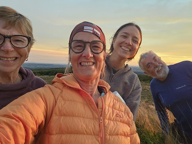
Our friend, Jo, was on her way into Mangaehuehu Hut with another friend as they were planning on going around the mountain over the next few days. They arrived about 6.30pm, surprised to see us, but it was lovely to be able to spend the evening with them. Over the evening, the hut started to fill up with a heap of Te Araroa walkers who hadn’t planned to stay there like us. We decided that we had better book in officially so we could legitimately claim a bunk. I think that by the time night fell, a hut that had only had a third occupancy when we first checked was now full! It made for a lively atmosphere. Interestingly, too, the demographic was entirely different from the previous night in Blyth. Blyth was full of people our age – late 50s to 70! Mangaehuehu’s average age was probably mid 20s (not counting the 3 of us!)

The wind was blowing, but the skies were stunning, and so, rugged up we sat outside to enjoy the sun going down.




Sunday
We had a lazy start to Sunday. There was no need to rush as we only had 6km back to the car.

Jo and Karen were heading round to Rangipō – with winds getting up high by midday, they needed an early start. I was nervous that the winds, even in the morning, would be too strong, and other walkers who had come from Rangipō to Managehuehu yesterday shared the same concerns. However, there were 5 or 6 of them all heading towards Rangipō, and they were all prepared to give it a go. In the end, it took them over 6 hours to walk to Rangipō – all of them clocked over 12km on their GPS watches – not the 8.5km on the DoC information. Jo said afterwards that she had never been so scared – the wind blew her off her feet several times, and she feared for her life. Another walker had been blown off his feet and sustained a broken wrist. They helped him down to Waihohonu and then out to Whakapapa and drove him to Taumarunui to the hospital.
Our walk out to the road was uneventful. It was windy, even down at the altitude we were walking at and several times I wondered how Jo was faring. The maunga was clear as we went past the Rotokawa Pools, still no reflection, but cool clouds!

I had a very bracing plunge in a pool at Waitonga Falls, and then we ate our sandwiches in the sun as I dried off.

No handstands on this trip, so this will have to do!

Footnote: It turned out that Nigel had low iron levels, which was probably the reason for his lack of energy.
Leave a comment