Another weekend looking for a weather window. Ruapehu looked good, if a little windy. We decided to get away late Friday afternoon and walk into Blyth Hut, walk on to Rangipō the next day, stay there overnight and then walk out on Sunday. Sunday would be a long day, but the weather looked good.
That was Plan A. We ended up doing Plan B.
Friday Evening
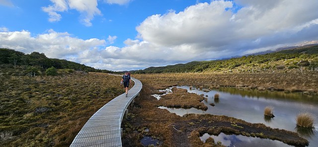
The walk into Blyth Hut is relatively short but pretty. The first section is on easy trail through Beech and Kaikawa (Mountain Cedar) forest. It emerges into an alpine wetland area where we followed an elevated boardwalk. We stopped briefly to look at the reflections of a cloud-shrouded Ruapehu in the wind-rippled Rotokawa pools.
Rotokawa Pools – Ruapehu hiding in the clouds!
Nigel walking along the boardwalk by the Rotokawa Pools
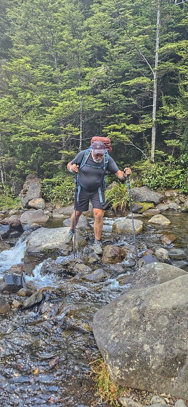
The boardwalk then descends steps to Waitonga Falls. At 39 metres, it is Tongariro National Park’s highest waterfall, formed by water carving a path through the volcanic landscape of Mount Ruapehu. We crossed the river at the bottom and then carried on up through the forest to the junction to Blyth Hut.
Waitonga Falls
Crossing the river
The signpost said 30 minutes to Blyth Hut. The first part winds steadily up through the Beech forest before coming out on more open, rocky ground. A large boulder perches on the edge of the slope with views down the valley.
Large erratic perched in the valley
Nigel emerging from the forest
Our route took us to the left, rock-hopping along the trail that followed the river. We arrived first at Lupton Hut – a private hut owned by Wanganui School, then crossed the river and up a zigzag track across a boulder field, up some steps and into the clearing of Blyth Hut.
Zigzagging up the boulder field – you can just see Nigel in the trees!
It was a beautiful evening, the hut was quite full, so we found ourselves a bunk, made dinner and then sat with the other dwellers to watch the sun go down.
View from Blyth Hut down the valley
View of Ruapehu from the window of Blyth Hut
Sunset from Blyth Hut
Saturday
Saturday dawned as a beautiful day. We wanted to get a reasonably early start as we knew we had around 15km to walk to get to Rangipō. The plan was to get to Mangaehuehu, stop for lunch and then carry on the 8.5km from there.
Morning sun catching Blyth Hut
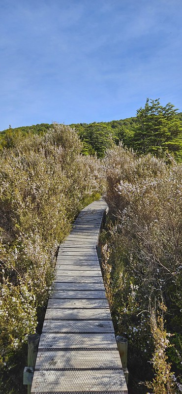
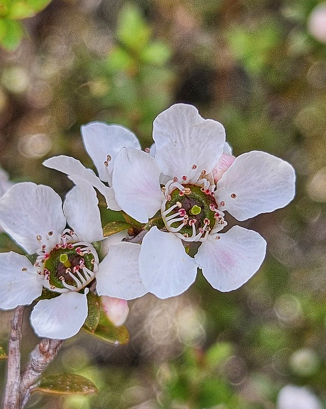
The first section is a steady climb through Beech forest and full flowering Mānuka, which was stunning. The photo really doesn’t do it justice.
We emerged into alpine tussock along a path that today was relatively dry, caked mud, but I have known to be wet and greasy. Interpersed there are bits of annoying boardwalk that have a wide gap, so your toes get caught between the lats! However, the views down to the valley and up to Ruapehu made up for the awkward terrain.
It was at this point that I noticed that Nigel seemed to be slowing down. I was in the front getting my stride on and hadn’t really noticed how far behind he was. It gave me a chance to take photos and look around me more closely. As we had seen last week on Taranaki, there were plenty of mountain daisies, eyebrights, hebe and heather (an invasive species which tends to smother natives, so there is a programme of eradication going on using the Heather Beetle), and of course, the golden red of the tussock grass.
When I got to Mangaehuehu Hut, there was a group of 4 walkers also just arriving from the other direction. I had a bit of a chat with them, consulted the map, checked the distance and waited for Nigel. It is a small hut, and the 4 of them took up most of the space inside. Despite the sunshine, the stiff breeze made it a wee bit cold to sit outside, so we decided once Nigel arrived and had a bit of a rest that we would carry on up the track to find a sheltered picnic spot. If truth were told, the 4 young men were a little bit smelly too! The first part from the hut took us back into the beautiful Beech forest, I love walking through it – the dappled light, lovely and soft underfoot and the sound of the wind blowing the trees.
Beech Forest
Just over a kilometre further on, I found a wee stream that seemed like a perfect spot for lunch. I was surprised again at how long after me it took Nigel to get there. He is normally behind me, but not by much.
Picnic spot
Onwards through the last bit of bush and out into the desert. This is my happy place. I love the open wilderness feel – big sky above, vast terrain in front and all around. But the wind! Oooph! It hit us as we came up and out into the open. The ground underfoot is rocky, and the path is not really unclear, but you do have to pick your route across the rocks, so it isn’t easy walking.
I waited for Nigel to catch me up, and again, he seemed to be labouring. I carried on, but then decided that he may need some help. I found a place to stash my backpack and went back to him. 400m back, I met him, took his pack off him, and we retraced my steps to where I had stashed my bag. We did this 2 or 3 more times – each time I would walk on for a km, then go back 400m, take his pack and go back to my backpack.
Crossing the Rangipō Desert
The wind was quite strong now; a couple of times, I was blown sideways, my poles were taken from under me and once I actually lost my feet and staggered to stay upright. After we had gone about 4km from the hut, we checked the map. It still seemed to be another 6km at least before we would reach Rangipō, despite the information on the DoC site saying it was only 8.5km. It was time to make a decision.
Eliptical Cloud
Decision Time
I can’t remember what time it was, but at the speed we were going, it looked like another 2 – 3 hours at least to get to the hut. We also still had a lot of climbing to do as the path trended uphill to Rangipō Hut, which is the highest hut on the Round the Mountain track at 1600m. In and of itself, that wasn’t a problem, but Nigel had no energy. He could have grunted it out; he would have got there, but it is such a stunning environment, and you really want to enjoy it. He clearly wasn’t! Added to that, we had to walk back the next day, the forecast was for much stronger winds, and we had a 16km day according to DoC distances, but a 20km day based on what we had done already!
I asked Nigel to be honest about how he felt. He said he felt as knackered as he had at the end of our epic Pyrenean hike earlier in the year! Decision made; no point in continuing on and slogging out. Let’s turn around and go back to Mangaehuehu. There seemed to be plenty of bunks left, so we didn’t bother booking one (we had already paid for a bunk in Rangipō!). I did a few legs of back and forth carrying Nigel’s pack, but then we decided it made more sense for me to get back to the hut and bag us a bunk as we had met 4 people also heading in the same direction and wanted to get a good spot!
I managed to overtake all of them on the way back – I was hoofing it, which probably didn’t do my knee much good! When I got there, I dumped my stuff on a couple of bunks and then went back up the hill to find Nigel. The general trend back was downhill, so I didn’t have to go too far to find him, but he was happy to pass me his pack and do the last 800m or so without it.
Nigel coming into Mangaehuehu Hut
Our friend, Jo, was on her way into Mangaehuehu Hut with another friend as they were planning on going around the mountain over the next few days. They arrived about 6.30pm, surprised to see us, but it was lovely to be able to spend the evening with them. Over the evening, the hut started to fill up with a heap of Te Araroa walkers who hadn’t planned to stay there like us. We decided that we had better book in officially so we could legitimately claim a bunk. I think that by the time night fell, a hut that had only had a third occupancy when we first checked was now full! It made for a lively atmosphere. Interestingly, too, the demographic was entirely different from the previous night in Blyth. Blyth was full of people our age – late 50s to 70! Mangaehuehu’s average age was probably mid 20s (not counting the 3 of us!)
The wind was blowing, but the skies were stunning, and so, rugged up we sat outside to enjoy the sun going down.
The setting sun on the tussock and Ruapehu
Sun setting over the valley
Crazies on the maunga!
Weird and wonderful cloud formations over Ruapehu
Sunset from my bunk window
Sunday
We had a lazy start to Sunday. There was no need to rush as we only had 6km back to the car.
Jo and Karen were heading round to Rangipō – with winds getting up high by midday, they needed an early start. I was nervous that the winds, even in the morning, would be too strong, and other walkers who had come from Rangipō to Managehuehu yesterday shared the same concerns. However, there were 5 or 6 of them all heading towards Rangipō, and they were all prepared to give it a go. In the end, it took them over 6 hours to walk to Rangipō – all of them clocked over 12km on their GPS watches – not the 8.5km on the DoC information. Jo said afterwards that she had never been so scared – the wind blew her off her feet several times, and she feared for her life. Another walker had been blown off his feet and sustained a broken wrist. They helped him down to Waihohonu and then out to Whakapapa and drove him to Taumarunui to the hospital.
Our walk out to the road was uneventful. It was windy, even down at the altitude we were walking at and several times I wondered how Jo was faring. The maunga was clear as we went past the Rotokawa Pools, still no reflection, but cool clouds!
I had a very bracing plunge in a pool at Waitonga Falls, and then we ate our sandwiches in the sun as I dried off.
No handstands on this trip, so this will have to do!
Footnote: It turned out that Nigel had low iron levels, which was probably the reason for his lack of energy.
New Year 2026 – the weather across Aotearoa is looking pretty crap, but the west coast (Te Ika ā Māui) looks like the best we’re going to get for the short time we have unless we stay in the Tron. So, we loaded up the van and headed off to Taranaki Maunga. Drove through the Waikato & Te Rohe Pōtae in wind, rain, sunshine, blue sky and threatening clouds.
We stopped for chips in Mōkau – highly recommend the wee roadside kiosk, and ate them overlooking the sea in one of the spots of sunshine.
We stayed at the Taranaki Aviation and Technology Museum – a great wee NZMCZA POP we have stayed at before. The museum is also well worth a visit. We arrived before sunset and enjoyed a pleasant evening in the sunshine.
Day 1: Kōkōwai Round Track
It promised to be a beautiful day, and we set off reasonably early to drive up to the Visitor Centre.
Our plans had been a bit fluid as we weren’t sure where we would be able to park. The main aim was to walk the Kōkōwai Round Track – a 12km loop described by DoC as:
“From the visitor centre, follow the Holly Hut Track through subalpine scenery to the junction with the Kōkōwai Track, just past the Boomerang Slip. Descend the Kōkōwai Track through forest to where it joins the Kaiauai Track. Turn right to head toward Egmont Road. Return to the visitor centre via the Ram Track (longer and overgrown in places) or by walking up the road.”
We had been prepared to walk it in reverse if necessary, depending on parking. DoC was advising that parking would be restricted as they are rebuilding the Visitor Centre, but we found a spot in the main car park. Clearly, everyone else had read the information too, and all the pull-ins at the side of the road were full.
The climb from the visitor centre is easy going on a well-groomed, tree-lined trail. We came out above the trees to see a path stretching out in front heading towards the maunga. A perfect place for a New Year handstand! It took a few goes to get one as the terrain was not as flat or as wide as we first thought, and it was very windy!
Handstand!
Onwards and upwards until we turned right off the ridge, then headed along the Holly Hut track that skirted the maunga just below the treeline. The trail descends steadily and crosses a few streams. The views across the valley floor were stunning, as were the changing faces of Taranaki Maunga as the clouds blew across it and created patterns in the sky.
A changing sky and the track traversing the maunga
Clouds!
It was easy going along Holly Hut Track, so there was plenty of time amnd opportunity to look around at the spectacular views. We crossed Boomerang Flat and then we soon came to the the junction where Kōkōwai track goes off.
Looking back along the track to the maunga and the path we had traversed.
Nigel crossing Boomerang Flat
We reached the junction quicker than we had expected, so we decided to carry on down to Holly Hut for lunch. It is a steady but quite downward trending track with shallow steps. The last time we did it was in reverse as part of the Pouakai Circuit. Nigel didn’t have good memories of that and we were going to have to come back out the same way!
Looking down on Ahukawakawa Swamp and Pouakai
At the bottom, the track to Holly Hut went left but we decided that the Ahukawakawa Swamp lookout would be a nicer place to have lunch so we went right. Five minutes later we emerged from the track into the boardwalk and the swamp. The 360 view of Pouakai and Taranaki from the look out is fabulous. “The swamp was created by a lava extrusion known as the Dome, which, combined with a later debris flow, blocked the Stony River (Hangatahua). The swamp contains a wide range of plants that can survive in acidic soils at low temperatures.”
Nigel walking into the swamp with Taranaki Maunga behind
Ahukawakawa Swamp and Pouakai
Bulbinella hookeri or Māori Onion
Korare of Harakeke
After a quick bite to eat, a few photos of the flora and the views, we set off back up the trail. In a book I read recently it said that the trauma of a bad walk in the hills takes 5 – 6 yrs to dissipate. You know how it goes – you have a traumatic experience – dreadful weather, too unfit, an accident or injury and you vow never to go back and do it again. A few years later (for most, but it seems that for trail runners the memory is much shorter!) there you are again, on the same track! The last time we climbed this track, Nigel really was unfit, the weather had been pretty bad on the previous day and he was tired, so the route from Pouakai track to here seemed interminable. This time, heaps fitter amd carrying only a day pack, it was certainly much easier!
We soon made it back up to the junction – I found another good lookout spot while I was waiting for Nigel – plenty of flowers to take photos of and a great view back towards the swamp and up to Taranaki. It was another good handstand spot and this time the terrain was flatter and soft!
Hebe
Then down Kōkōwai track. The DoC description was fairly sketchy, but looking at the map, it seemd that we would follow the ridge along before dropping down quite steeply into the valley. It was cool to keep high along the ridge and have views all around us as we descended gently.
Looking along the ridge from the top
Looking back along the ridge to Taranaki Maunga and the Holly Hut Track
The ‘skeleton’ trees stood out bleakly white against the lush green of the vegetation. These are remnants of the old forest which was decimated by the introduction of possums.
Skeleton Trees
Unlike the Holly Hut Track, this was a rough, narrow track that meandered along the ridge for a while before dropping steeply. It was overgrown and, at times, quite eroded so there were big steps to negotiate lined with roots and mud. There were times when my walking poles were more use as tools to fight my way through the vegetation and see where to put my feet!
Gnarly as … downhill!
Just as ridges descend, they also climb and so although we were trending downards, we did a fair bit of climbing too. As we went down the vegetation grew thicker and the trees taller. We knew we were still on the ridge as we could hear the wind – or was it the roar of water in a river? I really wasn’t sure but looking through the trees we could see the steep drop down to the valley. It was hard going bushwhacking our way through the vegetation and it seemed to go on forever! This was the gnarliest trail we had done in a long time! I decided it deserved a GAF categorisation (Gnarly as fuck!)
You can just see the trail!
Horopito
Eventually, we came to the junction with the main track to Pouakai and from there it was only 20 minutes or so of relatively easy trail. A walk in Aotearoa wouldn’t be complete without a swingbridge and this trail duly obliged.
Nigel crossing the swingbridge
We had a final choice to make which I actually think we had made a long time back; up the road for 3kms or more gnarly trail on the Ram Track? We decided that the road was preferable to negotiating more of the same as we had just done! A 12km walk had turned into 19kms and we were ready for a cup of tea!
On 20th February 2021, I ran the furthest I have ever run and am confident that it will be the furthest I will ever run in one go! Let’s wind back the clock about 12 months or maybe even 24 months. In January 2019, Nigel and I with our friends, Jo and Rob, set off on an adventure to do the Old Ghost Road. Jo and I ran/walked it whilst Nigel and Rob mountain biked it over 4 days. It is an amazing adventure, the scenery is just stunning, the history is fascinating and we were blessed with fantastic weather too. It’s 85km long and the recommended direction for biking is from Lyell to Seddonville simply because you get the steep sections out of the way in the first two days and you go down the spiral staircase instead of having to carry bikes up it! Jo and I walked the first two days faster than the boys could ride because the ‘push’ in pushbiking was more in evidence than the ‘biking’. It’s pretty hard pushing a bike with panniers on uphill, narrow, exposed tracks! Much easier carrying a pack and walking.
Anyway, we all agreed it had been a fantastic experience but felt that 4 days gave us the chance to take in the views, enjoy the terrain and each other’s company. The huts are great and we had time to chill at the beginning and end of each day and not be under pressure to move faster than we felt was comfortable.
So that was that. Great memories, appetites whetted to do more overnight tramps and Great Walks, especially in that area.
Well, until February 2020 that is! A message comes through from Jo. “I’m thinking of doing the Old Ghost Ultra in 2021”.
I distinctly remember Jo saying after we finished in 2019 that she really didn’t want to do Old Ghost in one day, it was a crazy idea, why would you run it and not be able to enjoy the scenery?! The conversation went like this;
“Really!?” I replied.
She said, “Well, it’s my 60th birthday on 19th Feb, the race is on 20th Feb. I’ll be up an age group. Seems like a good thing to do for my birthday. Do you want to support me?”
“Of course. A trip down south sounds good. I’ll travel with you, be at the start and meet you at the end. Maybe go for an explore while you’re running.”
“Oh no! By support, I meant will you run with me?”
“Whaaat! But I’ve never run that far before. I’ve always said I don’t want to run that far. I’m happy with short distances.”
“But you’ve done 4 Oxfams!”
“Yes, but that was walking.”
“We’ll do it together, you know you can walk that far. You’ve done heaps of running since. A bit of running, a bit of walking. We’ll be sweet.”
My fatal mistake was not immediately saying no! Maybe there was a little bit of something in my head and my heart that nagged at me to give myself a challenge? So I looked at the course, looked at the times people had done it in. I checked the cut off times. They were scary! Considered how quickly we had done 85kms on Oxfams, compared elevation… maybe, just maybe, I could do it. Bugger! She who hesitates his lost… or at least persuaded. Before I knew it I’d signed up to a Squadrun training program and Jo and I were locked in! Training commenced!
Covid19 lockdown happened. Our training was all local, along the river trail in Kirikiriroa on my own. We still hadn’t actually entered the event as it wasn’t open for registration until June. The event is limited to 300 people and it sells out fast! June 1st saw us in separate houses, at our computers, credit cards at the ready, OGR event page on count down, ready to hit that enter button as soon as the event went live, hoping that we both managed to get a place. My fingers were clearly faster as I ended up with race number 45. Jo was 118 but we were both in!
Now it was real! The Covid rahui was over and we hit the trails with a vengeance. I had gradually been increasing my running frequency from maybe 2 – 3 times a week to 4 – 5 times a week. Runs were getting longer and faster. Weekends were filled, running dominated. Wherever Nigel and I went, I was always looking for an opportunity to run. I became pretty adept at squeezing runs in on my travels for work. Fortunately the days were getting longer and so that made it easier to find time.
We decided to enter the Poronui Passage marathon in September. This is billed as the ‘Luxury Marathon’ and it isn’t cheap. Then again, most events aren’t cheap and we figured we might as well pay for an event on trails that we wouldn’t normally be able to run on. It was to be my first ‘official’ marathon; whilst I had run further than that before (Taupo 50 in 2019), I had never actually entered a marathon event. It was a harder day out than we had expected but amazing, big scenery. I struggled with cramp in my quads and calves from about halfway but plodded on. It was all very runnable – not my sort of trail at all! I much prefer some gnarly hills either up or down to allow me to walk! But we finished mid-pack in 5hr52 which was within our target time. The freezing cold knee deep stream a km before the end was bliss on tired muscles, and the beer went down well too! One of the luxuries was a hot shower and then delicious burgers and fries and as much beer or wine as you could manage! (Not much after a day dehydrating in the sun!)
Our next big adventure was the Squadrun Old Ghost Camp.We would run half the course on Saturday, the 2nd half on Sunday. Great back to back training. That was another fastest fingers first experience! This time only 12 places so we really did need to be quick. I was so quick, I inadvertently managed to book two places! Fortunately, it was very easy to sell on with some help from Ali. It was a fantastic weekend away in December, just 2 months out from race day. It gave us the opportunity to test the cut off times and gain some confidence that we could actually make them! I had a horrific time on the first day – my calves tightened and then my quads about 15km away from the hut. I couldn’t really run, so limped my way down the Boneyard and along the valley to the Stern Valley hut. We were running with some cool people and we all chivvied each other along, having fun taking photos and waiting for each other at wee stops! The 4 of us arrived at the hut and went to put our legs straight in the river where the fast guys had also stashed the beer supply – what a welcome treat! – before getting changed. I then spent some time with my legs up against the wall after massaging with magnesium oil and then Omrub. I was dreading how they would feel the next day and wondering how on earth I’d be able to run another 42 km! Doubt had really set in.
It’s amazing how well our bodies recover, though! A hearty feed (thanks to Ali), plenty of fluids, a long sleep and the next day, I was as good as gold. There’s a big climb in the second half to Ghost Lake Hut but after that it’s 24km of downhill. Jo tried out her poles. I had forgotten to bring mine. However, she soon gave up on them in frustration and I ended up using them thinking that they might help my legs. Downhill might be less taxing than up but I was still worried that my cramp might flare up. Using the poles took some of the pressure off, I think or maybe it was just in my head but either way, it worked! I definitely got slower, legs were tired, there was probably more walking than running but we kept up a steady pace and made it down with plenty of time before the cut off (when the shuttle bus was leaving to take us back to Westport!)
So, that was it. All we needed to do now was keep the training steady and maintain frequency. No need for any really long runs now just a couple of 30km shuffles and in no time we were into tapering!
We had done really well all through training – one of the mantras of trail running is about getting to the start line. You can’t finish if you don’t start! OGR Ultra has a limit of 300 runners. There were nearly as many as that again on the waitlist. Every year almost everyone on the waitlist gets in because so many people sign up and then get injured. We had been sensible, trusted the programme, and we were still injury free (apart from the usual niggles of nearly 60 yr old bodies!).
Then, after a short run around the lake – one of the speed sessions in the last 3 weeks, Jo complained of her Achilles hurting. Rest was in order. She rested a couple of days then tried again. Still sore. Her brain went into panic mode. We’d trained for this all year, we were almost there! Physio sessions revealed both tendons were inflamed. Nothing could be done except rest. We had done enough training, two weeks rest would be fine – physically but not mentally! So much messing with a head that didn’t need it! Jo is an amazing runner and a true friend. She has supported me all through the year, encouraging me, telling me I can go faster and further. But she is always a head case leading up to an event! (self-confessed!) Having a niggly, painful injury was a disaster.
In the meantime, Jo had been also wondering whether to use poles or not. There had been lots of discussion on the Squadrun FB page. Most people recommended using them for the 2nd half. Nigel had bought me some for Christmas and so I was planning on using mine – I’d practised with them whilst we’d been on holiday up north. Jo needed to practise with hers if she was going to use them. We planned a run up Maungatautari solely to practise. It seemed to go well. We weren’t any slower than usual and were probably a little bit faster. With the Achilles flaring up, the decision was made for her. Poles looked like they were going to be very useful for protecting her ankles.
More stress when Jo went to check our accommodation booking to find that it had seemingly been cancelled by BookaBach!! Manic messaging went on, rabid internet searching to find an alternative and we ended up with what we decided was a better deal. Serendipitously, there was a spare 4 person room at the Rough and Tumble Lodge where the race actually started from. That would mean we didn’t have to get up at silly o’clock to get a bus from Westport! Result. Panic over.
Finally, we were on the plane. This was it! No more to be done just turn up and run! Except that the pesky Achilles raised it’s ugly little heel again! On Thursday evening’s gentle jog on the first part of the trail, Jo struggled. On Friday, Jo’s birthday, we spent time trying to find a physio in Westport. A vain hope! I think Jo’s brain went into overdrive again. Walking was fine – we wandered out to the seal colony and distracted ourselves by watching the baby seals lolloping over the rocks and playing in the waves. Then we headed back into Westport, registered, met up with all the other Squaddies, had dinner and then went to the event briefing. Various people were singled out for thanks for their contributions to the event organisation. The oldest and youngest competitors were identified, those who were running for the 3rd, 4th, 5th ….. times, and those whose birthday it was! Just Jo – Happy Birthday was sung! Back to the Rough and Tumble and pretty much straight to bed after laying out all our gear, food, water, ready to put on when we woke at 5.30am. It was going to be a long day next day!
At breakfast, Jo broached the subject of what we would do if her Achilles were so sore she couldn’t continue. There wasn’t really a choice – the only way off the course is by helicopter for those who are injured, or who don’t make the cut offs. If you are uninjured and make the cut offs, then you stay on the course. But we had to voice it, and have a plan. It might just as easily be me who wouldn’t make it given my history with cramp. I hadn’t allowed that thought to really take hold in my head, though it was always there nagging on my shoulder! We agreed that the other would carry on. Then we ate breakfast in silence both struggling with our thoughts and doubts.
On the start line, we bumped in to other runners who we knew. Nervously chatted, wished them all luck. Jo disappeared off the the loo and I lost her 5 minutes before the start! She had missed the actual toilets and gone in the bush! We’re both pretty blind without glasses and in the dark with lots of torchlights glaring! Then the countdown started and we were off. There is never a surge at the start – well not unless you’re a front runner! We went with the flow of the crowd at the back, jogging gently up the first 500m to where we went under the entrance to the trail. At this point, it narrows to single track and we pretty much stopped – as 5 lanes merged into one! We then settled into a steady pace, Jo chatting to all and sundry by my side, me just in my zone. I’m not a great talker on the trail – mainly because I don’t have enough puff – but also because on this day I needed to steady my thoughts and focus. I found myself running with someone else in the dark; I could still hear Jo behind me but she wasn’t right behind me. Then I realised that I couldn’t hear her voice anymore. I thought that the footsteps behind me were her but when we reached a swingbridge – one person at a time – and I stopped at the other end for her, it wasn’t her! I waited. She was only a couple of minutes behind, still chatting to a lady who we were going to play leapfrog with for the rest of the day!
As we ran along the river it got lighter. The sun didn’t really make it out until we got higher, so it was actually quite pleasant running in the cool of the valley. The kms clicked by steadily. We were a little under our target as we had probably underestimated how long the first 2kms were going to take as the field spread out and then the waits at a couple of swingbridges. But we were still on target and we reached the first checkpoint at Specimen Point (17km) with about 25 minutes to spare. What we hadn’t factored in was that the cut off was when we left the aid station not when we arrived, so we needed to be swift. The volunteers were fantastic, they took our bottles off us and filled them while we chomped on the food provided, then helped us put them back in our bags. 10 minutes later we were out of there. 15 minutes leeway and we had 4hrs15 to run the (25km) to get to and then out of the next cut off at Stern Valley at 42km. There was a fair amount of climbing to do but we knew we just needed to plug away at it. Then, a few kms out of Specimen Point Jo mentioned she had some hotspots on her heels. Should we stop and deal to them? No, she reckoned she’d be ok, we’d get to Stern and then sort them. We’d always worried about the first two cut offs because they are pretty tight but we reckoned if we could make them the next ones were more achievable. As we climbed up from Goat Creek to the Hanging Judge we got our poles out. Jo’s hotspots were getting hotter. Should we stop? We decided again to carry on. Down through the Boneyard. The terrain is unforgiving – built for mountain bikers, it is made up of 3-4cm stones that are angular and shift under your feet. We were getting closer to the cut off time but still ok as long as we could get through quickly. We had bags to pick up at Stern Point with food supplies in, we needed more water and Jo really needed to sort out her blisters. Should we go through fast and then stop on the other side to do the blisters or stay in the checkpoint? We decided to stay in as there was somewhere to sit. I fed Jo food while she took her shoes and socks off to reveal huge blisters that had already formed on her heels. The volunteers again were fantastic, kept giving us time checks and helped however they could.
We made it out of there with 3 minutes to spare! Definitely not what we had planned but we were still in the game! Jo’s blisters were still very sore – they hadn’t popped so the pressure was huge. Every step was painful. We had 3 and a half hours to go 12km which included a huge climb to Ghost Lake Hut. It had taken us less time than we had thought on the training camp weekend so we thought we should be ok.
The sun was out and it was hot! Even in the shade through the forest the heat was overwhelming. I meant to grab water from the streams and waterfall on the way but was conscious of keeping moving so didn’t. Jo was getting slower. She was in so much pain. I know when Jo stops talking that things are getting bad. We focussed on putting one foot in front of the other. I tried to keep the pace steady but not too fast but I was constantly doing the maths in my head. I knew Jo would be doing the same. Would we make the next cut off? We reached the Skyline Steps, up and onto the top and across the ridge. The photographer greeted us here – what an amazing spot for a photo! I told him that the last twice I’d been up there, I’d done a handstand. He asked if I wanted to do one today. I said no! I sort of wish I had but it just didn’t seem the right thing to do! We paused for enough time to have a photo taken together. That ridge seemed to go on a lot longer then we remembered from last time! Then we reached the end and could see Ghost Lake Hut across the valley in the distance. It still seemed a long way away! And we had to go down and then up again to get there. By this time Jo was really struggling. She normally romps up the hills leaving me in her wake. I found myself needing to keep up my own pace but then stopping to wait for her. We have always run together but we have different strengths and so we go at our own paces ups and down and on the flats and then wait for each other. The sun was blazing by now. We passed a runner who was pretty much flaked out on the path. We asked if he was ok and needed some help. He said he was fine and then started moving again. (He ended up being helicoptered out attached to a drip – apparently the heat accounted for a lot of people)
As we climbed the last 2-3km to the hut, Jo said she didn’t think she was going to make it. I think up until that point I had been shutting out that possibility from my mind. We were only here for Jo – it was her event, for her birthday and I couldn’t really contemplate her having to drop out. I think I blithely said, “it’s ok you can do it, you’ve coped with worse blisters on Oxfam, you’ve been here before, we can do it together.” But in my heart, I knew that at the speed we were going we wouldn’t make the cut off at Lyell Saddle. She did too.
The handstand I did the last time I was on Skyline Ridge!
We got to Ghost Lake Hut. The guys on the FB live feed were there chatting to people, sharing messages from friends and family. They tried to talk to us, passed on messages from Rachel, from the Cambridge Crew. We didn’t engage like we had at Specimen Point. We were in a whole new world of pain – emotional and physical. We got Jo up to see the Medic to get her feet looked at. I went to get bottles filled and some food and took it up to her. It didn’t look good. I accidentally touched Jo’s ankle with my foot as I moved close to her, she almost hit the ceiling. The medic was concerned about the blisters but also about the severe tenderness under Jo’s feet and the sensitivity of the Achilles. She wouldn’t pop the blisters. She dressed them and then Jo tried to put her shoes back on. No go. At that point the Medic took the decision out of Jo’s hands. We wept, clinging on to each other. Bloody blisters!!! After all the worry about Achilles, blisters were going to end her day.
I set off from Ghost Lake with 10 minutes to spare. Apparently, Nigel and Rob were watching the live feed willing us to get out before the cut off. As I was getting ready to leave, the guys on the live feed asked me where Jo was. Rachel was wondering. I said she was with the medic. I didn’t want to say on the live feed that she wasn’t carrying on. They asked if they could go up and talk to her but the medic cut them off and told them to stay away. I’m not sure what happened after that.
I left feeling very sorry for myself but more sorry for Jo. As soon as I was out of earshot I let the floodgates open and I belly sobbed. Tears streaming down my face and taking big gulps, I let it all out! Then I turned to anger. The unfairness of it. This was Jo’s event. Everything we had done was because this was her special goal. I wouldn’t have been here, fit enough mentally and physically to do this thing without her. Why was it that I was still on the trail and she was sitting waiting (in far more grief and anger than me) for the ‘helicopter of shame’ as she called it. I shouted at the world, then I opened my eyes. I had rounded the corner and was looking at the trail curve out in front of me. Magnificent mountains and valleys, a cloudless blue sky. What a place! What a privilege to be here. I still had 30km to go, another cut off to make. No point in wasting time on crying or anger. I had also trained hard for an event that had become a goal and now I could either wallow in self-pity or I could get on and do this thing for myself and for Jo. I did some more maths. How fast did I need to go to get to the finish before it was too dark? Our half unspoken goal of 13 and a half hours was well gone, so we’re the spoken goals of 14 and 14 and a half! I’d been out there for 10 and a half hours already. Daylight would be gone, especially in the forest, by 8.30 at the latest. If I could do 30km in 5 hours then I’d be in before 9.30pm. 10min kms. I didn’t even factor in the cut off at Lyell Saddle, I was going for the end at this point. I took a deep breath.
I tried in those 30kms to appreciate the whenua around me. The trail along the ridge to Heaven’s Door and beyond is stunning, dropping down into goblin forest, the forms of the trees are beautiful. The steady downhill was hard on tired legs and the unrelenting stones that move underfoot were murderous on my ankles. Eventually I made it to Lyell Saddle. I had overtaken a couple of people and some had overtaken me but on the whole it had been a lonely section. Somehow though I had settled into my rhythm; I’d watched the kms tick away at under 10mins so was happy with my progress. At some point in the forest I had decided to put my watch on charge, worried that the battery wouldn’t last the distance. At Lyell I checked to see if it had taken some charge to find that it had plenty of charge but that it had stopped recording my run. Bugger! I unplugged it and set it going again.
At Lyell there were people who Jo and I had leapfrogged in the first part of the event. They asked where she was. All of them said they were sorry to hear that she had been forced to pull out. I refilled my water, had a few lollies. Once again the volunteers were so kind. They held my poles, helped me unscrew my bottles when I didn’t have the strength to do so myself. I was in danger of crying again so I decided I needed to get out of there! I had made up some time and left Lyell with half an hour to spare. 18kms to go.
All downhill from here. I motored on half walking, half running. I warded off the cramps in my quads and calves that threatened by trying to relax my legs as they swung through and concentrating on letting my poles take the weight. I overtook several lone runners, was overtaken by a couple of greyhounds who I then overtook further down the trail. It started to get darker and the km markers counted down. I remembered from our training weekend that some of the markers were missing. I wondered if they still were missing. I got to 5kms to go. I was still doing calculations in my head. It was pretty dark by now but not dark enough to stop, take my pack off, rummage for my torch and lose my rhythm. I let my eyes get accustomed to the dark. It was just like caving!
I caught up with a couple with teddy bears in their packs, who had overtaken me earlier. He was trying not to use his torch but his partner had hers out. I walked and talked with them for a few minutes but the light distracted me so I pushed on. Then I saw a bright light in front of me. It was someone coming up the track. About 3kms to go. It was Ali. We exchanged a few words – not sure if she realised it was me. Not far now. I felt lights behind me and some mountain bikers came past. I still resisted stopping to get a torch out, it was fully dark by now but I only had 2kms to go.
I could hear the noise of the finish line. It spurred me on. I wondered who would be there. I was feeling quite emotional by now. The reality of running/walking 85km – actually finishing this thing that I had been training for for the last 12 months – started to hit home. So did the fact that I was on my own and not with my running buddy. She should have been with me. She was the only reason I even did this bloody thing! She had supported me everytime I had struggled on training runs. I faltered. How could I cross the line without her? Well, I had to, didn’t I otherwise I wasn’t going to get to my bed tonight and boy, did I need my bed! I heard a voice tell me that the bridge was just round the corner. I was nearly there. Yeah, right! People always tell you that and they always exaggerate! It was probably still ages away. But no, there it was, looming out of the darkness. Just as I reached it so did some mountain bikers and they overtook me. Onto the bridge in front of me just as I was about to cross the finish line! Seriously!? Did they not know how far I’d come and that this was my endpoint?
I followed them across the bridge and then they stood to one side to let me pass as they lifted their bikes up the steps. A couple were just crossing the finish line so I waited until they were over and then I came across. Standing blinded in the lights under the arch, I was a bit lost. Trying to hold back my tears, I smiled maniacally! I felt someone come towards me, put a medal around my neck and give me a hug. It was Jo. We clung to each other and I sobbed.
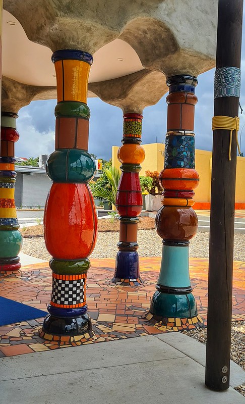
We made a couple of stops on the way home just to break the drive up a bit. The first was literally just a few miles down the road at Kawakawa to see the new Hundertwasser building. It really is beautiful and is worth a stop if you are up in the area. Te Hononga which means the joining of cultures is ‘a joining place, a meeting place, a coming together. This is symbolic of the joining together of our Kawakawa community and Hundertwasser, Maori and Pakeha, visitors and residents, our past and future, our places (east, west), of man and the environment.’
We spent some time talking to one of the locals who happily shared her kōrero about the place and how it was a real boon for the community. It’s a living, breathing building that is well-used but is also beautifully designed from the inside out. We didn’t do the tour of the inside as we had already dallied long enough and wanted to get home but maybe next time. Shee also commented how it had opened up a space in the street so that they could now see the whenua beyond and light came in so they felt more connected. It certainly seemed that way on a hot summer day!
We stopped for lunch at Ruakaka. It was probably my last chance for a swim in the sea but by the time we got there, it was bit grey and the wind had got up and I decided not to. I must be getting old or soft! There were plenty of folk in the water though.
It’s an interesting place – quite a nice beach but the view of the Marsdon Point is a bit of a spoiler!
We had our going home heads on now so pointed south and headed home. It turned into a lovely evening and as we came down past Huntly onto the new road, I suggested to Nigel that we stop at the Scientific Reserve. I’ve driven past a few ties in the way home from work or concerts but never had the time to stop. It intrigues me that there is a Scientific Reserve on the side of the motorway!
There is a wee walk that takes an hour or so to wander around. Natives and harakeke have been replanted and there is some wetland and a small lake – Te Iringa Lagoon. A short walk takes you to an information board which explains the meaning of the pou (Te Tihi) which stand high above the motorway on the right-hand side as you drive north. Unfortunately, there is no access to them and I have wondered as I have driven north what they represent.
“Te Kaahui Hakuturi” eight massive pou standing 20m above the ground look down on travellers at the summit of Taupiri Range. The pou acknowledge the path once travelled by the fabled Patupaiarehe and the creatures of the forest. The pou are carved from treated radiata pine and painted white with black detailing to acknowledge the spiritual connection which the Patupaiarehe have to the land. Each pou looks in a different direction across the landscape, guarding over all that drive through this whenua (land). This site was lowered by a 57m deep cutting and removal of 1.3 million cubic metres of earth.“
At Te Iringa Lagoon there are 4 waka standing on their ends;
“Four waka-maumahara (canoe cenotaphs) are an impressive sight. The waka-maumahara acknowledge the four winds, which blow through the valley and are a reference to the oral histories of Te Iringa. As with all oral history there are versions of events told by victor and vanquished alike, so no two are the same. The two mokomoko (lizards) are symbolic of the two brothers Tapaue and Wharetipeti who held domain over this site.“
It was well worth stopping and having a wander to learn about the place and the pou. Next time when I’m driving north, I’ll stop in Huntley to visit Whakataki. It also looks like there are some Pā to explore close to Gordonton.
Saturday was the Tall Ships Race in Russell. Chris and Ross were back in the harbour and invited us to join them on their boat. The plan was to sail out into the bays and then watch the other boats as they raced by then go to the Yacht Club shindig in the evening. We booked into the Top Ten Holiday Park in Russell so we could roll back to the van after the shindig and then we met Chris and Ross in Russell. We sat for a while on the jetty and watched the gannets diving. They are incredible – just circling around until they spot something then like a bullet straight down into the sea.
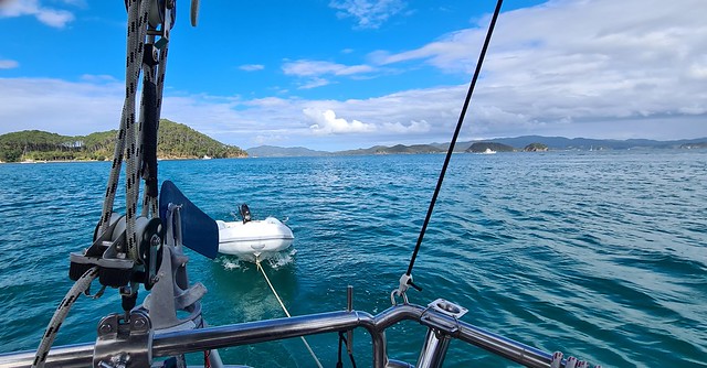
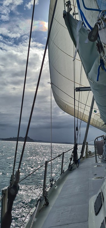
We headed out in the dinghy to the Sula that was anchored in the bay. Since the wind was pretty much non-existent we motored out for a while until the wind seemed to pick up enough to move under sail. It was lovely just sitting out on the wee bit of deck (I’m sure it has a proper name!), eating our lunch and catching up with Chris and Ross. We watched as the Tall Ships (most of them were just yachts but I think there was at least one official ‘Tall Ship”) sailed on out. The course had been shortened due to the lack of wind so we soon saw the front runners coming back again.
We headed out to Motuarohia (Roberton) Island where we anchored and then went onto the island to explore. There is a short walk with information boards that takes you up to the site of a Pā. The information boards are quite a work of art – images cut into rusted steel and then layered to give a 3D effect, but unfortunately, don’t provide any information about the island before Captain Cook arrived. Interestingly, this website starts by describing how the island had been inhabited for centuries by Māori but follows up by saying that the island was ‘first discovered’ by Captain Cook!
The view from the top is indeed spectacular and we spent some time up there working out the lie of the land and recognising places like Cape Brett, Moturoa Island, Urupukapuka. These were all places we had visited last year. We knew Tania and Scott were staying on Urupukapuka again and we wondered if on a beautiful day like today they would be out fishing. As we headed back down the hill, I heard a shriek – it was Tania and Scott coming up the hill! What a coincidence. It turns out that we had probably just passed another friend but deep in conversation, we had missed her. Tania saw her at the top and sent me a message but by then we were back on the boat!
Looking over to Moturoa and Cape Brett
Chris and I decided that a swim was in order and we dived off the boat. So good! The sun was definitely over the yardarm and so once back on the boat we cracked open a G & T. Perfect!
Back in Russell, we had dinner on the boat and then dinghied over to the Yacht Club to party into the night!
We met up with Chris and Ross the next morning for breakfast before hitting the road back home. It was so good catching up again. Now that we’re all on the same island, we might see more of each other!
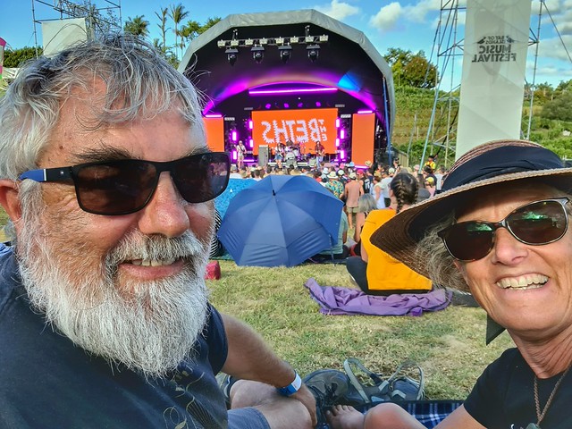
I still don’t know if Nigel actually guessed what his Birthday surprise was – there were huge posters at every visible hoarding in and around Kerikeri and all over Northland advertising the Bay of Islands Music Festival and he gets all the emails advertising music events so I would be surprised if he didn’t have an inkling. Anyway, he humoured me and pretended that he hadn’t guessed!
The stinger was that we had had beautiful weather for over two weeks and the day when I really wanted it to stay warm and dry, a weather front was forecast and the 8th January was due to be wet and windy! Just typical! But I had been watching the weather and by Thursday evening the front which was originally due on Saturday but was arriving early on Friday seemed to have petered out a bit. It was now going to start raining Thursday evening, carry on all night and be fine by 3pm Friday afternoon. The festival was due to start at 3pm on Friday afternoon! Let’s hope the forecast was right now. I realised that even if the rain stopped the ground would be wet and so we probably needed a waterproof something to sit on and so after a birthday breakfast in Kerikeri, I stopped in Bunnings to get a picnic blanket.
I got Nigel to drive so that I could navigate and off we went to Kainui Road Vineyard. The rain had stopped and the sun was coming out. Armed with rain jackets, sunscreen, water bottles, a few snacks and blankets, we found a spot near the front on a not too slopey bit of the amphitheatre and then went to have a look around at the food stalls and to get some beer.
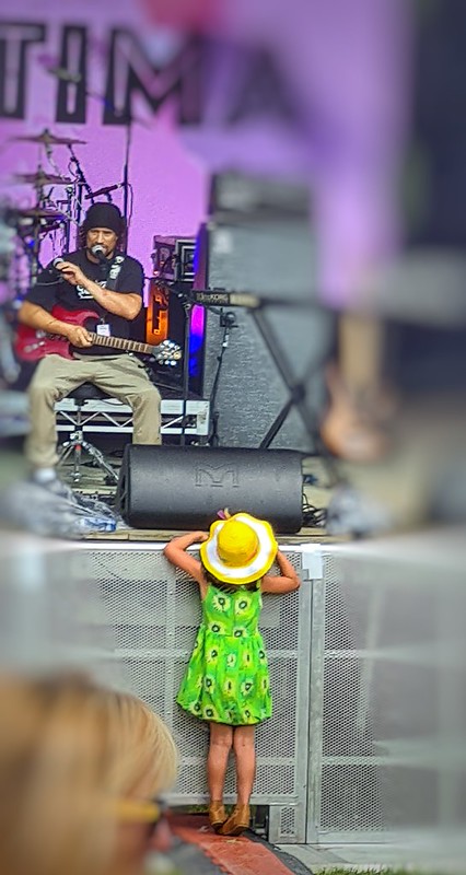
Unfortunately, Tami Nielsen had had to pull out as she had been hospitalised earlier in the week. That was a disappointment as she was one of the acts I had wanted to hear. Interestingly there was no announcement or any indication at all that she wasn’t going to be playing. I only knew because I follow her on Instagram and she had posted the day before. Hopefully, we’ll get to another of her concerts soon.
Her replacement was a young local musician called Ben Ratima. He was very good and a relaxed way to start the afternoon off. He was a really unassuming fellow; he played one of his songs called Calling all Angels and admitted that he had misspelt it when he wrote it and published to Soundcloud so that it actually reads ‘Calling all Anglez‘. Anyway, it’s worth a listen.
Next up was Melodownz. Very much in the same vein as Avondale Bowling Club and they upped the tempo a bit. Clearly more well known and appreciated by the younger folk in the crowd. I love music festivals like this because they are events for young and old alike. Music lovers really tend to have eclectic tastes and appreciate a range of music so although mostly the youngsters were up and dancing there were plenty of oldies in there too.
One of the headline bands that we had gone for was up next; The Beths. We saw them just after lockdown in Raglan at the YOT Club. It was a very small, cosy gig with just 100 or so people so very different to a music festival with maybe 1000 in the outdoors. We weren’t disappointed. Such fabulous music works anywhere and Liz Stokes is a consummate professional who just makes good connections with the audience.
Up next was one of New Zealand’s favourite sons – the eponymous Dave Dobbyn. To be honest, I don’t think I’d ever knowingly heard any of his songs but I certainly recognised some of the tunes when he sang. We took the opportunity to wander off and get something to eat just before he was due to start as we really weren’t that bothered about hearing him. We came back to find most of the crowd, young and old crowded around the stage, dancing and singing along – we only just managed to rescue our blanket and shift it a little bit up the hill. Toddlers were sitting atop their parents’ shoulders singing the songs and waving their arms – they must force-feed them his CDs in the car! I have to say that I can’t quite see why he has such cult status, but then I wasn’t growing up in the 70s in New Zealand and I understand that for the teenagers then he brought something new and fresh to the music scene that compared to the music coming from the US and the UK. I thought I’d better take at least one photo!
The headline act was BENEE. All the kids had been running round in sweatshirts 6 sizes too big for them all afternoon and now they rushed to the front to get prime position. I was intrigued to see how she performed live as I had heard that she had been disappointing in a previous live concert. However, those thoughts were quickly banished when she started singing and then when she engaged with the crowd. She was incredibly personable, she spoke directly to people especially the kids and she is a natural performer without being pretentious at all. The crowd loved her and we really enjoyed her performance too. She finished by bringing a group of wee girls who were being squashed at the front up on stage with her. It was clear that three of them were friends but the fourth one was on her own. So, the lovely thing was, when the three joined hands to dance together, BENEE took the other little girl’s hand and danced with her so she wasn’t left out. So special, those kids will remember that for a long time!
We had decided that a change of scenery might be good for us. Never let it be said that I had tired of beaches and the sea but my poor skin was bearing the brunt of my penchant for the sea and coast. So, into the forest we went.
In the Kauri Forest
The ngahere is one of my happy places, the coolness and the trees and the sounds of the birds and insects. “Puketi Forest is an ancient kauri (Agathis australis) forest located in the heart of New Zealand’s Northland. Along with Omahuta Forest, it forms one of the largest contiguous tracts of native forest in Northland.” We have been here before to see the Kauri Trees on one of Nigel’s birthdays – we bought cakes from a bakery and the four of us sat and ate them under the majesty of these mighty trees.
Off we go!
This time we were just two and we had bikes – I had insisted we bring them and so we were damn well going to use them! The Pirau Ridge Track is an ‘easy 11 km walking track, with walking and mountain biking opportunities’. Sounded good and it connected with the Pukatea Ridge track that goes through a beautiful regenerating Kauri forest. So ‘we’ thought it would be good to cycle to the junction, stash the bikes in the forest, go for a walk in the forest and then cycle back again. Easy peasy!
Nigel on a down!
It pays to look at a proper map before believing Doc information. If we had have done so we would have seen that the track crossed lots of contour lines! In itself that’s not bad – we’d done plenty of hill-climbing after all! But hilly metalled road with 2 inch grade gravel is not the best terrain for rolling bike wheels over either up or down! The first km was flatish but then it started to climb and when we got to the top of the first hill, it went down again. What goes up must come down and that’s pretty much what happens for the next 8km! Thankfully the gravel reduced in size somewhat after 4km and was easier to navigate. Being in the forest might have been pleasant enough, we heard some birds and the forest kept most of the sun off us but there are no views and it isn’t really very pretty. But the killer was that every 200m or so there was a possum trap, and pretty much every trap had a possum in it and some of them were positively minging! They were the humane traps that drive a spike through the possum’s brain and kill it instantly as it tries to climb the tree. The smell of death was at times overpowering – and just try not breathing deeply as you’re trying to get up a steep hill!
Kauri Bark entangled in an epiphyte
So, we we were glad when we got to the junction. We stashed our bikes as planned in the bush and set off on the walking track to find a pleasant place to have lunch. Our plan to go for a sizeable walk was tempered by the thought of retracing our wheels back the way we had come. The forest really is beautiful though. We quickly came to stands of Kauri that went deep on either side of the track. Although it is is another ridge track, at this point, it seems quite wide and there is a boardwalk on some of the path. There were Kauri of varying ages, some quite tall and wide, others still small but plenty of them. We wandered through appreciating the majesty and beauty of the forest especially after such a grind to get there!
A knot!
The Kauri and the broadness of the ridge peters out after about a km and the path starts to descend. At this point, the path is less well defined and we decided that we should head back and find a spot on the boardwalk to have lunch.
The return journey was less of a challenge than we had expected – maybe we were just inured to the smell and the grind of gravel!? – and we were soon back at the van. Time to head to Kerikeri and the relative civilisation of Chris and Ross’ section which was to be our campsite for the next few nights.
I was tempted to stop and take a photo of one of the many dead possum but couldn’t quite make myself get off the bike and get close enough! But I found this tiny skull in the undergrowth – it wasn’t neatly arranged like this! I found the pieces and put them together. Not sure what it is – too big for a mouse – could be a stoat …?
I had an early start with a run along the beach. I’d planned to just run out for as far as it went and then back again but aiming for 12km. Not my favourite running terrain but I needed to get out and do something after a couple of days mooching about. After a chat with my running buddy Jo, I decided that the hard packed sand might be good to do one of our sprint runs on the programme. So, I dragged myself reluctantly out of bed at 7am having been prepared the night before and made sure my shoes weren’t hidden in the cupboard under the bed!
A pristine beach – Tangaroa has done his stuff!
Our question about how often the beach returns to its pristine condition was answered. Not a tyre track in sight – beautiful!
I wasn’t really feeling it but set off and decided I’d just go with the flow; if the speed didn’t happen I’d just stick to my original plan of 12km. But then again the speed work would mean it would all be over more quickly and I could go for a swim sooner! Haha! Such are the mind games when we run! The undulations from the waves were a bit of a surprise and made it a bit difficult getting into a rhythm but I worked out a way of picking my way between and over them and settled into the warm up. Surprisingly, when I was called on to up the speed, all went well. I had to do a ten minute warm up then 4 x 1km reps at 5min 10secs pace with 2 minutes recovery between each then finish with ten minutes cool down. A sensible person would have done two reps then turned round and come back but I sort of still had it in my head that I was going to do 12km so I just kept going! Madness! Very pleased that I hit my target pace and then came back to complete 12km. I had another 2kms to walk to get back to the van but that was good for stretching the legs and cooling down even more before I jumped into the sea for a swim. Bliss. It turns out that Tokerau Beach is 15km long so just as well I didn’t try to go as far as I could before turning around!
Half way – the speedwork done, now to jog back the way!
Back at the van we had a leisurely breakfast, packed up and were on our way by 11am. Our vague plan was to head towards Mangonui, have a tutu there looking at some Pā sites – there was actually a 12km walk on Wildthings that linked them all up but Nigel had also seen that we could drive to them so we decided to do a bit of both!
By the time we arrived at Mangonui it was midday and we were ready for a coffee and a wee snackette of something. We pottered around the art gallery and the shops and then headed out to Rangikāpiti Pā. Rangikapiti means “Gathered together”.
Looking down to Mangonui
It is a stunning spot with 360 degree views. It’s a while since I’ve done a 360 photo but this was a perfect spot. It also seemed like a good spot for a handstand! Minor hitch was that I was wearing a skirt – but I just did what I used to do as a kid and tuck it into my knickers!
“Local traditions suggest that Moehuri made landfall at Mangonui from the canoe Ruakaramea, along with his son Tukiato. Moehuri was guided to the area by a shark, after which he named the locality (mango meaning shark, nui meaning big or great). As thanks to his guide, Moehuri placed his protection over the shark.” (from DoC brochure)
After spending some time at the top trying to imagine what it would have been like living up there with that vantage point, working out the access points and the natural defensive lines, we headed down a track. It took us through some beautiful shaded bush – more cicada serenaded Manuka – to a point where the terrain got steeper and there were ropes strung from tree to tree. I navigated my way down for a while until it was quite rugged and it was clear that the path, such as it was, was just going to lead down to the rocks at the end of the headland. Definitely a good defence from attack!
Looking down the coast to Cooper’s Beach and then beyond from where we have travelled.
We climbed back up and to the car to drive rather than walk to Cooper’s Beach and the next wee ramble around the Taumarumaru Reserve. This beautiful walk takes in several Pā and stunning beaches. It was so hot though and we were wilting in the heat! There are three Pā sites in this reserve;
Taumarumaru Pā looking towards Otanenui Pā
“Taumarumaru consists of Taumarumaru Pa itself, two smaller pa named Te Homumu and Otanenui and nine other associated sites including small, isolated complexes of pits and terraces, midden, gardening soils, and gardening plots delineated by a network of reticulated drains. Together this collection of sites represent a typical prehistoric or protohistoric archaeological landscape of a large, central pa or defended village, smaller headland pa, open or undefended sites or kainga and associated areas of food preparation and or consumption, and gardening plots.”
Looking across to Te Homumu Pā
The story of who built them and lived there is all tied up with Rangikāpiti Pā. Let’s go back to Moehuri and the shark;
“Some years later when his own son Tukiato killed the shark, he and his accomplices were banished from Rangikapiti and established their own pa at the western end of Coopers Beach, called Otanenui – ‘The place of the old man Tamure’ was named after the large old snapper found in abundance nearby. The slopes below the pa were gardened and produced good crops of kumara, hue (gourd), and the first potatoes, pumpkins, marrows and European fruit was grown in the area.” More information can be found in this linked brochure.
We wandered around the reserve, visiting each of the Pā and the small beached between them. It is an inspiring and interesting place and we reflected on how easily it could have been lost to developers as it really is prime real estate. Māori clearly picked it for its position and we’re not sure how it escaped the urban sprawl but somehow out did. What a jewel and a real asset as it stands to the rohe.
Standing on Te Homumu Pā looking back towards Otanenui Pā (the hidden headland beyond the one in the photo!)
Finally, we headed down to Cooper’s Beach and I had another swim. We had heard people talk about Cooper’s Beach and we can see why it is a popular spot. The beach is so pretty and the water was deliciously warm and the waves gentle.
Cooper’s Beach looking towards the coastline. Te Homumu Pā is around te next wee headland.
Looking at Cooper’s Beach from my vantage point in the water!
By now we were hungry! A quick stop at the supermarket for some supplies for the next day and then back into Mangonui. Mangonui is allegedly the best place in Aotearoa for fish and chips. So, we decided that if there was place to park and if there wasn’t too big a queue and there was something vegetarian for Nigel, we would have tea here. If not, we’d head down to Puketi and prepare dinner in the van. Quite a lot of ‘ifs’ there but time was getting on and it was going to be another hour before we’d get to Puketi so we were willing to give it a go. The Atua must have all lined up because all the ‘ifs’ came together. We had to wait about half an hour but that soon went by with a beer. I have to say that whilst the fish and chips were good, I’m not sure they beat Raglan Wharf for price and value combined with freshness and tastiness. Maybe they are a victim of their success and have got greedy. At Raglan the portions are twice as big, half the price and just as tasty!
Anyway on the road again and off to the coolness of the forest. A bit of a trek on metalled road for the last 12 km or so but we settle into the DoC campsite in Puketi Forest Park for the evening with some different sounds around us – and bitey things for the first tin=me all holiday. The drawbacks of a forest!
One of the places we noticed as we looked for a campsite yesterday evening was an olive grove and an invitation to taste. I suggested cycling out from the campsite – it was only a few km away but Nigel wasn’t convinced. In the end, we called in on our way out to Maitai Bay. It’s a small family-owned place and unfortunately, as a result of not being able to harvest as many olives as normal due to COVID lockdown, they had pretty much run out of olive oil and had no olives left at all. Anyway, we had a taste of the oil and bought a bottle to take away.
Cicadas
We headed out along the peninsular to Maitai Bay and walked the Headland Loop. This is a short walk (4km) that goes from the top of the DoC campground, through a field above the beach and then through Manuka forest out to the headland where there are spectacular views of the bay and across the sea. We walked from where day visitors can park which adds another km or so to the walk. The first thing we noticed was the sheer quantity of honey bees buzzing around the Manuka trees – photos just don’t capture it. Then a weird creeping plant that grew over the Manuka and seemed to be strangling it. We haven’t seen it before so will need to try to identify it. There were also a couple of other plants that we haven’t seen many of before – some work to do on identification.
Welcome coolness in this shady avenue of Manuka
As we left the paddock and entered the avenues of Manuka trees the noise of the cicadas intensified – I love their sound and for me, it is a real sign of summer and they remind me of the south of France too. I can’t help but start singing a very irreverent French song the chorus of which goes like this:
C’est la chanson des cigales
Pendant que les fourmis travaillent
Les cigales elles se régalent
Les pied en éventails
(Translation:
It’s the cicadas song
Whilst the ants work hard
The cicadas party
their feet in a fan shape.)
You have to sing it with a Midi accent or it doesn’t really have the same effect!
We carried on through the manuka and then the path rose (not more hills!) quite steeply and we had views all around us. We reached a high point where it looked like there was a choice of path. The right hand branch was the one we wanted and the description didn’t mention another although it looked like a well-worn 4wd track for at least as far as we could see. Alarmingly, there was a rusty old-fashioned iron ‘Man Trap’ animal trap attached to the post the marked the way on. Clearly not in use but could be dangerous for little, inquisitive hands.
Looking down the left hand branch – looked promising but it didn’t go anywhere!
We started to descend the right-hand track – it dropped away quite steeply to the headland. I think we had imagined that we would end up at the highpoint of the headland but in fact, this track took us all the way down to the rocks by the sea and a view out across the bay.
It was a bit of a scramble after this point…
Looking back towards where Nigel waited
Nigel stopped as the path got more rugged and much steeper and watched me scramble down. Clearly these rock pools don’t get washed over very often as the water in them had evaporated leaving salt crystals.
Salt crystals in rock pools
Looking towards where the other track might have once descended to.
Once I rejoined Nigel we climbed back to the junction and I went for a brief exploration of the left-hand track. It pretty much only goes as far as you can see and although it has been a path in the past, it is now very overgrown and I gave up when the gorse started to scratch!
We headed back to the van and I had a swim while Nigel prepared lunch. Maitai Bay really is a beautiful beach. Interestingly though, after yesterdays little rant about cars on beaches, there are notices asking people not to drive on the beach to protect the dunes and the space.
Looking left to Maitai Bay from the highpoint by the pou.
There is also a rahui in place stopping people from fishing and collecting seafood. There are two beautiful pou on the top of the hill – (I wonder if it used to be a pā?) which were erected to mark the start of the rahui. They represent tupuna Kahutianui and Te Parata, and on the other side, the gods of the sea Hinemoana and Tangaroa.
Kahutianui and Te Parata
Hinemoa and Tangaroa
Winery
We decided to visit the Karikari winery to sample the local plonk. Officially the wine cellar was closed but they still let us in! It’s an incredible place high up on the hill with an amazing view. We were spun the spile and the wine was pretty good so we ended up getting a couple of bottles – one of their Chardonnay – unusual for us but it was a bit different and one of the reds. Looking forward to enjoying them at some point in the future!
View from Karikari winery
Tokerau Bay
By the time we got back to the van, it was time for food and then an evening walk on the beach. We wondered about how often the tyre tracks from the cars are washed away and the beach goes back to its natural state. There were still plenty of people driving along to do some evening fishing or maybe just taking a short cut along the beach – who knows? One hapless person had got themselves stick in the soft sand on the access road and was being pulled out by some locals. I wonder how often that happens?
A very lazy start to the day in paradise. A morning swim, leisurely breakfast, another swim and then time to pack up and move on. We had a vague idea that we would head towards the Karikari Peninsular and see what we could find to do there. We needed to dump our grey water as the tank was full and that probably meant we needed drinking water too. Electricity was less of a problem as the solar panels seemed to be doing a good job at keeping us ticking over and a hot shower might be nice too so we looked to book into a ‘proper’ campsite.
We tutu’d down the road and stopped on the way in Te Kao at the wee shop to get some essential supplies – bread, shampoo, milk and a beautiful kete. I wished afterwards that I had asked who had woven it but I will carry it and always know where I bought it.
Rarawa Beach
Then we pulled down to Rarawa Beach for a walk and to have lunch. We were a tad disappointed as neither of us had remembered that vehicles were allowed on it. We had remembered beautiful white sand that squeaked as you walked on it. It was white but it was flattened by the cars that were all along the beach. I’m just not sure what I think of cars on beaches. There was some parking at the end of the main road but not enough for the number of people who visit. Most cars were full of families with heaps of beach stuff; picnics, chairs, surf boards, boogie boards which I know are a pain to lug down from a car onto the beach especially when you have to manage kids as well. But I like the idea that my beach experience is a natural one, just people, maybe dogs (but I’m a bit ambivalent on dogs too) and maybe a trolley to cart all the stuff down but not motor vehicles.
The seagull which had been feeding on a fish on the beach – it flew away as we approached then went back to the fish once we passed by.
When we looked back at the photos from last time we were there, it was a couple of weeks later, the beach was deserted and there were no tyre tracks so maybe we just hit it at a very busy time and the rest of the year it’s all good.
Aforementioned fish
Nevertheless, we walked along to the end, beachcombing as we went and enjoyed some peace and quiet just sitting on the rocks looking out at the waves. I didn’t swim although I had planned to – it was a bit windy and I was put off by the whole experience.
We decided that the carpark at Rarawa wasn’t the best place to make food and time was getting on so we called in at Pukenui for some chips and a drink. Back on the road and our next stop was in Awanui for petrol and we also got some fresh tomatoes, a rock melon and sweetcorn from a roadside stall – all of which were delicious – so reminiscent of travelling in France and getting fresh produce from the side of the road!
Onwards to Karikari Peninsula and we ended up at Tokerau Bay campsite – it really is a case of sticking a pin in the NZMCA directory and picking somewhere! The first one was full so we just carried on. It’s a small site clearly been around for a while but quiet and family oriented. It was lovely to see kids playing on the grass in the middle of the campground. The amenities were old but clean and well-maintained. Our host was just lovely and told us how they have cut back on the capacity since COVID to ensure that everyone is safe and has space to keep themselves to themselves if they want to. We effectively had a double space all to ourselves!
The beach is interesting – it’s not the prettiest of beaches and because it’s long and flat it is used as a road and so vehicles hoon up and down. I’ve already expressed my views on cars on beaches but the problem in Aotearoa is that they are classed as public roads and beaches like this one are so long and flat that they are drivable. When I posted about it on Facebook with one of my photos a friend suggested that Tangaroa gets his revenge frequently when cars get stuck in the sand. It made me smile a wee bit when we saw a car having to be pulled out of the soft sand at the entrance to Tokerau Bay the next day! We watched someone on a trail bike racing down the beach, doing wheelies and hopping over the soft sand close to the dunes as we sat out in the envying sun on the beach. But mostly it was fishermen driving to their fishing spot and casting out their lines – still don’t know why they can’t just walk along the beach. I have memories of my Dad trudging along with all his fishing gear and standing on cold East Coast English beaches – maybe the Kiwis have the right idea after all?!
Warning: Attempt to read property "comment_ID" on null in /home/easegill/public_html/wp-content/plugins/subscribe-to-comments/subscribe-to-comments.php on line 81
Warning: Attempt to read property "comment_ID" on null in /home/easegill/public_html/wp-content/plugins/subscribe-to-comments/subscribe-to-comments.php on line 81
Warning: Attempt to read property "comment_ID" on null in /home/easegill/public_html/wp-content/plugins/subscribe-to-comments/subscribe-to-comments.php on line 81
Warning: Attempt to read property "comment_ID" on null in /home/easegill/public_html/wp-content/plugins/subscribe-to-comments/subscribe-to-comments.php on line 81
Warning: Attempt to read property "comment_ID" on null in /home/easegill/public_html/wp-content/plugins/subscribe-to-comments/subscribe-to-comments.php on line 81
























Recent Comments