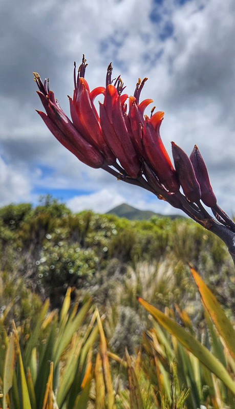
Tag: Taranaki

Adventures in Aotearoa: Taranaki

adventureAotearoafaunaholidayleisureNZwalks

January 2026

20260102_091418

Part 1: Taranaki

New Year 2026 – the weather across Aotearoa is looking pretty crap, but the west coast (Te Ika ā Māui) looks like the best we’re going to get for the short time we have unless we stay in the Tron. So, we loaded up the van and headed off to Taranaki Maunga. Drove through the Waikato & Te Rohe Pōtae in wind, rain, sunshine, blue sky and threatening clouds.

We stopped for chips in Mōkau – highly recommend the wee roadside kiosk, and ate them overlooking the sea in one of the spots of sunshine.

20260101_145356

We stayed at the Taranaki Aviation and Technology Museum – a great wee NZMCZA POP we have stayed at before. The museum is also well worth a visit. We arrived before sunset and enjoyed a pleasant evening in the sunshine.

20260101_181904

Day 1: Kōkōwai Round Track

It promised to be a beautiful day, and we set off reasonably early to drive up to the Visitor Centre.

Our plans had been a bit fluid as we weren’t sure where we would be able to park. The main aim was to walk the Kōkōwai Round Track – a 12km loop described by DoC as:

“From the visitor centre, follow the Holly Hut Track through subalpine scenery to the junction with the Kōkōwai Track, just past the Boomerang Slip. Descend the Kōkōwai Track through forest to where it joins the Kaiauai Track. Turn right to head toward Egmont Road. Return to the visitor centre via the Ram Track (longer and overgrown in places) or by walking up the road.”

We had been prepared to walk it in reverse if necessary, depending on parking. DoC was advising that parking would be restricted as they are rebuilding the Visitor Centre, but we found a spot in the main car park. Clearly, everyone else had read the information too, and all the pull-ins at the side of the road were full.

20260102_091510

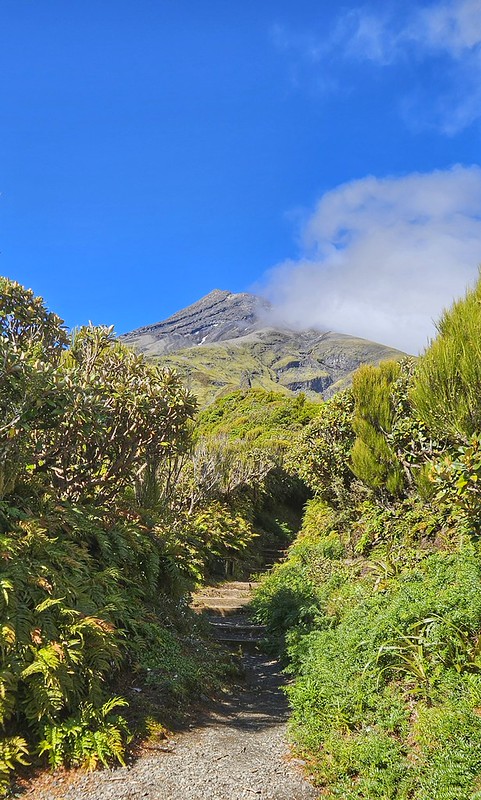
The climb from the visitor centre is easy going on a well-groomed, tree-lined trail. We came out above the trees to see a path stretching out in front heading towards the maunga. A perfect place for a New Year handstand! It took a few goes to get one as the terrain was not as flat or as wide as we first thought, and it was very windy!
20260102_094153
20260102_095747_029
Handstand!

Onwards and upwards until we turned right off the ridge, then headed along the Holly Hut track that skirted the maunga just below the treeline. The trail descends steadily and crosses a few streams. The views across the valley floor were stunning, as were the changing faces of Taranaki Maunga as the clouds blew across it and created patterns in the sky.

20260102_101758
A changing sky and the track traversing the maunga
20260102_105217
Clouds!

It was easy going along Holly Hut Track, so there was plenty of time amnd opportunity to look around at the spectacular views. We crossed Boomerang Flat and then we soon came to the the junction where Kōkōwai track goes off.

20260102_111852
Looking back along the track to the maunga and the path we had traversed.
20260102_110206
Nigel crossing Boomerang Flat

We reached the junction quicker than we had expected, so we decided to carry on down to Holly Hut for lunch. It is a steady but quite downward trending track with shallow steps. The last time we did it was in reverse as part of the Pouakai Circuit. Nigel didn’t have good memories of that and we were going to have to come back out the same way!

20260102_113637
Looking down on Ahukawakawa Swamp and Pouakai

At the bottom, the track to Holly Hut went left but we decided that the Ahukawakawa Swamp lookout would be a nicer place to have lunch so we went right. Five minutes later we emerged from the track into the boardwalk and the swamp. The 360 view of Pouakai and Taranaki from the look out is fabulous. “The swamp was created by a lava extrusion known as the Dome, which, combined with a later debris flow, blocked the Stony River (Hangatahua). The swamp contains a wide range of plants that can survive in acidic soils at low temperatures.”

20260102_120707
Nigel walking into the swamp with Taranaki Maunga behind
20260102_120933
Ahukawakawa Swamp and Pouakai
20260102_121529
Bulbinella hookeri  or Māori Onion
20260102_122310
Korare of Harakeke

After a quick bite to eat, a few photos of the flora and the views, we set off back up the trail. In a book I read recently it said that the trauma of a bad walk in the hills takes 5 – 6 yrs to dissipate. You know how it goes – you have a traumatic experience – dreadful weather, too unfit, an accident or injury and you vow never to go back and do it again. A few years later (for most, but it seems that for trail runners the memory is much shorter!) there you are again, on the same track! The last time we climbed this track, Nigel really was unfit, the weather had been pretty bad on the previous day and he was tired, so the route from Pouakai track to here seemed interminable. This time, heaps fitter amd carrying only a day pack, it was certainly much easier!

20260102_124625

We soon made it back up to the junction – I found another good lookout spot while I was waiting for Nigel – plenty of flowers to take photos of and a great view back towards the swamp and up to Taranaki. It was another good handstand spot and this time the terrain was flatter and soft!

20260102_132506
20260102_132206
Hebe
20260102_132833_030

Then down Kōkōwai track. The DoC description was fairly sketchy, but looking at the map, it seemd that we would follow the ridge along before dropping down quite steeply into the valley. It was cool to keep high along the ridge and have views all around us as we descended gently.

20260102_133202
Looking along the ridge from the top
20260102_133639
Looking back along the ridge to Taranaki Maunga and the Holly Hut Track

The ‘skeleton’ trees stood out bleakly white against the lush green of the vegetation. These are remnants of the old forest which was decimated by the introduction of possums.

20260102_134728
Skeleton Trees

Unlike the Holly Hut Track, this was a rough, narrow track that meandered along the ridge for a while before dropping steeply. It was overgrown and, at times, quite eroded so there were big steps to negotiate lined with roots and mud. There were times when my walking poles were more use as tools to fight my way through the vegetation and see where to put my feet!

20260102_140032
Gnarly as … downhill!

Just as ridges descend, they also climb and so although we were trending downards, we did a fair bit of climbing too. As we went down the vegetation grew thicker and the trees taller. We knew we were still on the ridge as we could hear the wind – or was it the roar of water in a river? I really wasn’t sure but looking through the trees we could see the steep drop down to the valley. It was hard going bushwhacking our way through the vegetation and it seemed to go on forever! This was the gnarliest trail we had done in a long time! I decided it deserved a GAF categorisation (Gnarly as fuck!)

20260102_141407
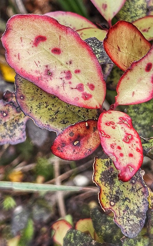
You can just see the trail!
20260102_142259
Horopito

Eventually, we came to the junction with the main track to Pouakai and from there it was only 20 minutes or so of relatively easy trail. A walk in Aotearoa wouldn’t be complete without a swingbridge and this trail duly obliged.

20260102_151308
Nigel crossing the swingbridge

We had a final choice to make which I actually think we had made a long time back; up the road for 3kms or more gnarly trail on the Ram Track? We decided that the road was preferable to negotiating more of the same as we had just done! A 12km walk had turned into 19kms and we were ready for a cup of tea!

Taranaki Day 2

NZ

The weather forecast was for it to be fine but clouding over as the day progressed, winds to increase and gradually give way to showers the following evening. The rain would become heavier by Friday. If we wanted to go for a decent walk on the slopes of Taranaki it would have to be today! It was after 12.30pm before we finally got ourselves together and arrived at North Egmont Visitor Centre. We checked that the route we planned was okay to do in the conditions, had a dither in the display area and shop and bought a map. Taranaki was in cloud and it was pretty cold as we added layers in the carpark but soon we were off. As we walked the cloud blew this way and that, first covering the peak and then leaving it clear and proud. The bank of cloud that had looked like a pretty solid front moving in from the sea seemed to dissipate a bit as it came over and most of the afternoon was spent with the sun shining. The biting cold was tempered by the sun and our own exertions warmed us up and we gradually shed the layers we had put on back in the carpark. The unremitting upward nature of the walk was made easier by the sight of Taranaki in front of us, and whilst the view behind us of the valley was unclear and hazy the same could not be said of the Mounga in front of us. How tempting is its snowy peak and how envious am I of those who have the skill and nerve to climb it in winter conditions?

As usual, Lachlan strode out in front with Nigel keeping pace for a while. Aonghas struggled as always to get going and moaned and whined about this hurting and that hurting and it being too hard and too steep! We have had this introduction to walks ever since he was tiny, but after about half an hour, he gets into his groove and is away. He is always a talkative companion on a walk and he kept me entertained as we trudged up along the snowy track. We stopped every now and then to throw snowballs, scratch names in the snow and look at interesting things that Gus spotted and had to investigate! We had the Transmitter Tower in sight as our goal (even though the walk didn’t go there, it was at least a visible point for Gus to focus on) and when we reached the track junction Nigel and Lachlanwere waiting for us. To climb higher or ro head downhill? Gus wanted to go up, so did I; we spent some time looking at the mountain side trying to work out which was the North Ridge, and how what we could see on the map equated to what we could see in front of us. How we miss the good old 1:25,000 OS maps, the maps here just don’t have the detail we are used to! A couple of weather beaten mountaineers who had climbed up there in the morning were on their way down as we were talking. They pointed out the route they had taken and the best ways to go in different conditions; a seed has been sown and I am determined to reach the top someday, but probably in the Spring or Summer time when the conditions are more favourable. They said that the path up to the transmitter tower was icy so to take care. We started on up but as we came to a bend in the track and a handy bench the route onwards looked very steep and very snowy and was glinting icily in the sunshine where it wasn’t in shadow. I carried on to have a recce and decided it was probably okay but communicating to the rest of the family in the wind wasn’t easy. The cloud had started to billow round the end of the spur ominously; Nigel seemed to be signalling that he wasn’t happy about coming up, so I descended, a little disappointedly but knowing that it was a sensible decision. As we continued to descend to the hut the cloud enveloped the mighty mounga and the sun all but disappeared. Then the sun came out and Taranaki was unshrouded and standing proud once again, then the cloud swirled

Look, you can lean back much further than if you are on flat ground!

around again… and so on for the rest of the afternoon.

The hut is simple but serviceable, and you can imagine how cosy it could be filled with the camaraderie of walkers, the wood burning stove blazing away, food being cooked and stories shared. Today, though, it was cold and empty and it felt a little forlorn. However, it afforded us some shelter from the wind whilst we ate some chocolate and had a drink before continuing down through the bush to the Visitor Centre. The route back was one of those frustrating ones where you climb down gullies on ladders only to regain the height lost on the other side. However, the ups and downs made the last kilometre or so more interesting and avoided that tired ache in the hips you get from trudging along a flat, boring path at the end of a long afternoon out!

Gus kept me entertained as we went, telling me all about when he did the Tongariro Crossing with Nigel and the Scouts. He says he finds it difficult to write at school when they have to do memoirs as he can’t remember anything – he didn’t have too many problems today once he was given a few prompts!

We arrived back to an empty carpark in the dusk of the evening, fell happily and tired into the car and back to the Bach on 45!


Warning: Attempt to read property "comment_ID" on null in /home/easegill/public_html/wp-content/plugins/subscribe-to-comments/subscribe-to-comments.php on line 81

Warning: Attempt to read property "comment_ID" on null in /home/easegill/public_html/wp-content/plugins/subscribe-to-comments/subscribe-to-comments.php on line 81

Warning: Attempt to read property "comment_ID" on null in /home/easegill/public_html/wp-content/plugins/subscribe-to-comments/subscribe-to-comments.php on line 81

Warning: Attempt to read property "comment_ID" on null in /home/easegill/public_html/wp-content/plugins/subscribe-to-comments/subscribe-to-comments.php on line 81

Warning: Attempt to read property "comment_ID" on null in /home/easegill/public_html/wp-content/plugins/subscribe-to-comments/subscribe-to-comments.php on line 81

See previous posts

Categories