Summer 2020 – 2021 Pandora Bay

beachcampervanlifeholidayleisureNZNZ Placeswalks

Nigel was ready for another day out. Well, he didn’t say he wasn’t and we had talked about going the other way from Tapotupotu Bay to Pandora Bay. The walk according to the DoC times and distances was either 9km or 10km and 5 and a half hours. After yesterday’s outing we were sure that it would be wrong so we decided to set off and see how far we got. I had done two reasonable runs in the last two days so was happy to go with the flow and walk more or less with Nigel. I set my watch to ‘hike’ rather than ‘Trail Run’ so that I wasn’t tempted to run. 

20210102_140507-01
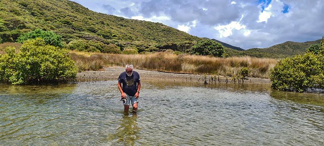
Mangroves in the river that flows into Tapotupotu Bay

The plan was to get away earlyish so we weren’t walking in the heat but it was 10.15 before we set off! The best laid plans of mice and men! 

Oof! It’s a pretty steep climb out of the bay after a gentle warm up on the boardwalk through the mangroves.  Once we reached the first high point we could see the path in front of us – climbing up and then dropping down, and then up and down! 

20210103_102645-01
Looking down to Tapotupotu Bay from the top of the first climb
20210103_105346-01
Nigel trugging up one of the hills

There was little in the way of shade but the views are amazing. After about 3km the path settles into a Manuka lined ridge still undulating but trending steadily downhill. Much pleasanter walking.

20210103_110421-01
Manuka avenues – provided brief respites from the sun

The junction to Pandora comes at roughly 7km. Nigel had already said he’d make a call there about whether to continue on or head back. The sign said 2km and 1 hour. We’d just done 7km in 2 hours but it had been steep and hot.

03/365 3rd January 2021
Looking down to the ridge we have just walked along. The track to Pandora goes off to the right a bit lower down. I climbed up to get the view.

We decided to continue along a red sandy track which seemed to hug the contours of a slope until we found a shady spot for lunch.  A few 100m further on there was a small stand of Kanuka trees which provided perfect shade for a picnic. 

20210103_123827
This track hugged the contours of the hill and eventually branched off down to Pandora Bay.

After lunch we carried on. Nigel decided he’d continue as long as the path was relatively flat. We soon came to a junction where the path looked like it was going to descend more steeply. There was also a path continuing on but very much upwards along another headland. It may have gone to a view point but we decided we didn’t need to go there! I continued on down. By our reckoning and Garmin’s navigation, and DoC signs (all considering any of those were accurate) it was another 1500m to Pandora. Nigel headed back. 

The path now descended steadily through forest, cool and leafy, a few wooden bridges crossed dried up stream beds, and it was a bit more uneven underfoot. I soon came out at the junction with the 4WD track that comes from SH1. Almost there! On my left as I went down the track there was a set of stairs which I had to investigate. They led to a rocky mostly dried up stream. There was a pool full of murky water…probably a good wee swimming hole when there is more water and also a dangerous swirly thing in flood! It looked like there would also be a decent waterfall dropping off from there in wetter weather.

Quick exploration over, I headed back to the main track and soon found myself at the Pandora Microcamp. This would be a cool wee place to stay; a grassy area with a shelter, a sink and water which presumably was fed from the stream I saw higher up, and long drop loos. There were also a few trees where you could pitch your tent to get some shelter and a great view of Pandora Bay.

20210103_132729-01
Pandora Bay

It was another few 100 metres to the beach so I scooted down there to have a swim. It was going to be a decent climb back up so I didn’t really want to do that either commando or with wet knickers. But…the beach was deserted apart from a wee fishing boat right at the other end ….There is something deliciously freeing and a bit naughty about swimming naked on an (almost) deserted beach! I swam out enough to see round the corner of the bay and then let the waves take me back to the shore.

20210103_131158-01
View from in the water….
20210103_131248-01
A welcome dip in the ocean

Body temperature suitably down, I sat on a rock for a few minutes to dry off then I got dressed. I almost lost my shoe in my attempt to wash my feet before putting them into my socks when the rock I had put my shoe on was washed over by a wave. Hopping on one foot (already with one sock and shoe on) I scrabbled to grab aforesaid shoe before it was washed away. In the process the other foot ended up fully under water too! Never mind, wet shoes and socks are all part of trail running and at least I still had two shoes!

20210103_132458-01
This way!

Re-energised and nice and cool, I set back off up the hill wondering when I would catch Nigel up. The return journey was simply a backwards version of the first 10km so little to report really except that it was now mid afternoon and stifling hot. The terrain provided little respite from the sun so in the patches where the path goes through the manuka trees it was hard not to dawdle and make the most of the shade.

20210103_111045
View out to Sand Dunes from the ridge

I ran out of water about 6km from home but still had a few 100ml of electrolyte which I rationed!  I bumped into the young couple from yesterday who once again expressed their admiration at my speed! They had parked their car at Spirit’s Bay, got the shuttle to Te Paki then tramped with full packs and tents over three days stopping in Tapotupotu and Pandora before finishing back at Spirit’s Bay. I reckon their effort was greater than mine! I caught Nigel up only a km from the van. He was just crossing the bridge over the river. 

Annoyingly,  I was going to end up on just under 20km so I had to ‘tidy up’ – past the van to the end of the beach and back again! 

When I got back to the van Nigel had made a cold drink for me – delicious! I persuaded him to walk down to the sea to plant his legs in the water,  I planned to swim but when we got there we were told that there had been a couple of sharks spotted quite close into the beach so everyone had got out of the water. We stood knee-deep and let the waves wash over us whilst scanning the sea for shark fins for half an hour at which point I decided to submerge myself in the shallows anyway!

20210103_155913

A good day out which ended up with more running and effort expended than I had expected. It’s interesting how the trails have been graded by DoC as neither yesterday’s trail nor today’s really seemed to fig the ‘Advanced Tramping Track’ label they have. I completed the 10km to Pandora in well under 3 hours, Nigel would have taken just over 3 hours, yet it is signposted as taking 5 and a half hours!  Go figure!

After a G & T, dinner and wine we ventured out to watch the sun cast its pink glow on the beach and the waves. Later on we sat on just looked at the night sky. So many stars and a such a bright Milky Way – I wish we could see it more often but in Kirikiriroa there is just too much light pollution. 

20210103_205212-01

Summer 2020 – 2021 Tapotupotu Bay

beachcampervanlifeholidayNZNZ Placestravel

Tapotupotu Bay

2021-01-14_11-12-21

We left Te Pua camp at Paua after a leisurely breakfast looking out over the estuary as the tide came in. I went for an ‘early’ morning swim aka 9am which was a lovely start to the day. And then we watched the rays come in again and feed as we ate breakfast. Fascinating. I should probably have waited longer for my swim as the water was much deeper and more accessible by the time we left at 10.30ish. I was tempted to jump back in but since we were heading to Tapotupotu Bay, I decided to wait. 

As we left the campsite we spotted two seagulls sitting on the fence – were they the same two we had seen yesterday?! Funnily enough, when we looked back on our photos from this place a few years ago, there were two seagulls sitting on the same bit of fence!

20210101_110600-01

We pulled in on the way at Radar Bush. It looks over to the east at the ridge line that runs from Tapotupotu Bay to Pandora Bay and is apparently where there were radar stations set up during WW2 to listen out for Japanese attacks. To the west and seemingly immediately in front of the pull in is where a pā once stood. You can see the depressions that would have been kūmara pits in the field. Across the valley, two obvious hills mark where other pā would have been. The sign says there are terraces that would have been where produce was farmed but they were difficult to make out. At the far end of the field there was a carved stone which looked a bit like a gravestone but one side of it was damaged and there was no indication of what it might be. Curious.

20210102_113808-02
2021-01-14_11-30-28
20210102_114420-01
20210102_115924-01

Anyway, onwards to Tapotupotu with an abortive coffee stop at the coffee cart on the hill – the coffee machine was ‘playing up’! 

The sign at the road end for Tapotupotu said there were no vacancies at the campsite. We decided to drive down anyway and see. There was space after all and we set up camp with a view of the sea. Our awning provided us with some decent shade and we had lunch. I might also have donned my togs and run into the waves! Delicious! (kai and moana!) We had a wee wander along the path into the mangroves just to remind ourselves of the place. It was lovely to wade back across the river to keep cool.

2021-01-14_11-40-17
View from the van
2021-01-14_11-40-54
2021-01-14_11-41-27

As the afternoon wore on, my legs got itchy! I read my book, did some of my Māori puzzles, went in the sea again and then decided to see if the 5km walk (10km return) to Cape Reinga was really going to take 6 hours. We can normally reckon on halving the times on DoC walking tracks. But this was billed as an Advanced Tramping track and they are a generally a bit more accurate. Even so 6 hours for 10km!? It was 3pm so I decided to give it 3 hours,  I’d run out for 90 mins and see how far I got then turn around. 

20210102_152829-01
Looking down at Tapotupotu Bay

Nigel accompanied me across the beach to where the track starts up the hill. It climbs steadily, then steeply for 1km before descending for 2km to the first bay. The trail is really runnable after the first ascent. Easy gradient through Manuka trees then steps wind down more steeply snaking along the ridge. There are a couple of diversions to viewpoints, one of which I went to, the other seemed a bit further so I decided to leave it for the way back if I had the energy. 

2021-01-14_11-49-00
20210102_155409-01
Sandy Bay

I arrived at Sandy Bay (3km) after 30 minutes took a little while to find the route onwards – this is the only place where the signage is lacking. I had spotted some people walking down what looked like a steep descent but wasn’t sure that it looked right, so I made my way to the back of the beach to where the vegetation met the beach. No way on there! I came back to where I could hear voices and came across the couple who I had seen descending. That was the way on and the track climbed quite steeply!  At first it was quite rocky and loose but that soon gave way to a grassy slope and then gravelly trail. I emerged onto the Cape Reinga tourist track with still 400m to go to make 5km. So I headed down the path to the lighthouse, took a couple of selfies then set off back up! 56 minutes!

20210102_161846-01
At the meeting of the oceans

Give me a target and I’ll go for it! By my reckoning, I had 3kms of down and 2kms of up on the return journey so that should be quicker, right? I promised myself a swim at Sandy Bay before the 2km climb. What a treat! I think I have set myself a new target – a swim in every new bay! 

20210102_163955_capture-01

Suitably cooled, I set off up the hill. Steady away, my legs were tired but I know how to plod! On the way down the last km I overtook a couple who I had met at the bottom of Sandy Bay on my way out. They were amazed that I’d gone there and back and was overtaking them. 

I arrived back at the van 1hr 43 minutes after leaving it! Boom! 

Nigel wasn’t there – I presumed he’d gone for a wander so I dumped my stuff and headed for a swim to cool off. He arrived back after I’d come back and got changed a little bit worried because he had gone to wait for me at the end of the track and hadn’t seen me come down. Somehow we missed each other but all good in the end. 

I had a treat of some freshly caught (and cooked) mussels from the people next to us who had too many – they even gave me a dressing to go with them which was yummy!

20210102_182036_capture-01

We had a wander on the beach in the evening as the sun went down and marvelled again at the night sky. Paradise!

Summer 2020 – 2021 Cape Reinga

beachcampervanlifeholidayNZtravel

New Year’s Day

20210101_075518-01

I started the day with a swim – the tide was in right up to the rocks so I scrambled down the wee cliff and waded in. It is surprising how clear the water is – it’s only shallow, about mid-thigh deep but enough to immerse and swim along the shore.

20210101_075450-01

Cape Reinga – the northernmost point of Aotearoa, where the spirits of the dead set off from Aotearoa to Hawaii. Strictly speaking they set off from a little rocky outcrop that has an ancient Pohutakawa tree clinging to it. It never flowers apparently but it’s where the spirits leave Papatuanuku and rise up to Ranginui. At Matariki, they are swept up by the waka as the star Pohutakawa rises – she is the star that carries those who died throughout the year onto their onward journey. I wonder now about the significance of the Pohutakawa star and the tree on the outcrop which is called Te Rerenga Wairua (where the spirits fly) 

20210101_123649-01
02/365 2nd January 2021

We have been here before but wanted to visit again. The sky was overcast and it started raining as we drove north. The place was packed – vans and cars parked all along the grass verges because the car parks were full. Luckily we found a spot next to a very badly parked hire car on our 2nd turn around the car park and managed to squeeze into it. We joined the masses walking down the track. The information boards are well done and I was pleased that I could read the Maori language ones and get most of the information before checking my understanding by reading the English. It was also interesting noting the translations and how ideas were interpreted in the two languages. 

20210101_123812-01
20210101_125106-01

The clouds swirled around and we decided that we would stick to our plan of walking from the Cape Reinga to Cape Maria van Diemen – well, getting as far as we could. It looked like it would be a bit too far as a first walk of the holiday and it was already late morning.  We packed up some sandwiches and snacks to have on the way and set off. 

20210101_161554-01

The track leaves the main Cape Reinga Tourist track about 500m down. It’s a well-formed trail that winds its way along the ridge after dropping down some stairs. There are a couple of wee side routes that take you to little summits with good views along the coast. You come out on Te Wērahi Beach after 2kms. The route from there is 3kms straight across the beach. At high tide it may be difficult to get around the first part. 

20210101_152633-01

We had set off from the top in mist and a light swirling wind and I made the mistake of not putting on sun cream and wearing a sleeveless tee shirt. I also forgot my hat! By the time we reached the beach we could see that the top of the hill was still in cloud but we were in full sun and exposed! I ran across the beach whilst Nigel walked across. At the other end, I waited for a bit then decided to run back towards him. 

20210101_145816-01
20210101_150820-01
20210101_150504-01

The track from the beach winds up on vegetated sand dunes until it drops down into the bay on the other side which is really just a continuation of Te Wērahi Beach.  From here you climb up over hard packed sand formations – quite the lunar landscape. We climbed up to a high point at about 6km. It looked like it was going to be another 3km to traverse then skirt around the back of the hill to access Cape Maria van Diemen. We were hot, didn’t have enough water, and so decided to make that our turn around point. It seemed like a good handstand spot so I duly obliged and we headed down to the rocks at the end of the wee jutty out bit to have lunch by the rock pools. 

20210101_190911-01
20210101_154443-01
20210101_154524-01

Suitably sated, we set off back along aforesaid exposed beach.  I ran again, Nigel walked which gave me time at the far end to have a swim before he got there. It was so good to immerse myself in cold water and reduce my body temperature. I decided to wade through the water back towards him – great resistance training! 

20210101_161649-01

Then the 2km climb back to the van. I had been doing my maths (Jo would be proud of me! ) and realised that to get 16km I needed to run back down the track for 750m then turn around. Madness, I know! I met Nigel about 500m down, but caught him up again halfway back up the tourist trail. Also bumped into Anahera and Alex…so lovely to see friends and colleagues out of context! 

20210101_120515-01

What did we learn (again!) today?  Always put sunscreen on, always take more water than you think you’ll need. I ran the last 7km wearing my spare long sleeved thermal top that is part of my emergency gear to protect my shoulders from the sun. So emergency gear is always useful! 

The landscape is amazing on this walk and we’ll definitely go back someday to do the rest of the route.

Back at Te Pua, I jumped in the water for another swim – it was still quite shallow as the tide was not fully in so I really just lay in the warm water and floated. Bliss! Later on we sat and watched the Rays feeding – I was tempted to go out and have a closer look but was too comfortable with glass of wine in hand! We watched the sun go down on the first day of 2021 and then marvelled at the stars and the Milky Way in a sky untainted by the glow of city lights. 

2021-01-14_11-14-03
2021-01-14_11-11-44

Summer 2020 – 2021 Plan B

adventurebeachcampervanlifeholidayNZ Places

Paua

Hogmanay morning dawned bright and sunny and when I woke at 6am, I thought I’d go for a run and then a swim. All galvanised to go, I then realised that my running shoes were under the seat under Nigel and he was still asleep! I had to be content with just the swim. I met Tania as I headed down to the beach and she came with me. What a lovely way to start the day! 

20201231_060138-01
20201231_125036-01

The rest of the day was spent travelling north through almost parched countryside so early in the summer. Drought looks like it will hit Northland heard this year unless there is some rain soon. We burled around in Mangamuka to take a photo of the radio station. “Tautoko Radio was established to give voice to our concerns for the ongoing wellbeing of our people, communities and environments, where the promotion and use of Te Reo Maori and Tikanga Maori is essential and expressive of an inclusive Universal Maori World View.”

20201231_132048-01

Years ago we had travelled over the steep and windy Mangamuka Gorge road and been appalled by the rubbish that had been tipped at the top and the lack of a view. We had vague recollections of a group of teenagers about to set off on their longboards down the road too – thrill-seekers! We weren’t sure if we were mixing memories of different places up, though, but when we reached the summit, it all looked very familiar. Pleasing that there seemed to be less rubbish but still no view!

20201231_134256-01

Our plan such as it was was to get to the Cape and stay at either Tapotapotu Bay or Spirits Bay to see the New Year in at the far north. We knew that it was likely that there may not be space – they are both DoC ‘first come, first served’ sites and sure enough, just past Pukenui, there was a sign that said both sites were full. Plan B. The sign indicated that Rarawa campsite still had vacancies so we headed down the metalled road to find that there was a no vacancy sign on the entrance. U-turn and consult the NZMCA directory! A campsite was marked at Paua so we decided to call to see if there was space. There was and so we headed down the road. 

20201231_162944-01

The campsite at Paua is on iwi land and run by the local iwi. It is right by the white sands in the Parekareka harbour. It is a shallow harbour, its coast lined with Pohutakawa Trees and Mangroves starting to form as you get further up the estuary. The tide was out when we arrived and people were out gathering shellfish from the flats.  We skirted around trying but failing to keep our feet dry! 

20201231_174903-01
20201231_175300-01
20201231_175016-01
20201231_174211-01
20201231_172223-01
20201231_180509-01
20201231_180313-01

6.30 and it was time for a Hogmanay aperitif! There was enough of a breeze to keep the midges away but not to be too cold. Nigel had bought a bottle of Champagne, partly for seeing in the New Year and partly for toasting the new van. We refrained from using the bottle to ‘launch’ her as that would have been a waste! It went down very nicely as a pre-dinner drink!

366/366 31st December 2020

The campsite was busy and everyone was friendly but pretty much kept themselves to themselves. We played cards, chatted and watched the sun go down on 2020. Pretty much everyone’s ‘annus horribilis’ but we felt very fortunate to be in Aotearoa and travelling freely as we read the news from elsewhere in the world. It was a full moon and we sat out on the wee hill above our camper van and watched the moon and the stars as midnight came and we saw in 2021. 

20201231_204902-01
20201231_211042-01
20201231_210617-01
20210101_000026-01

Summer 2020-2021 Pātaua North

adventurebeachcampervanlifeholidayNZNZ Placestravel

Heading north again but with a new campervan. Our old one died of rust from the inside out which was a shame as her engine had plenty of life in it yet.

20201229_142133-01
On the road #campervanlife

In a rash moment back in September, I saw an advert for the Bay of Island Music Festival in Kerikeri which just happened to be on Nigel’s birthday and I bought tickets without really thinking about the logistics. It meant that we pretty much had to head back north for our summer holiday. At the time I didn’t know for sure that the old van was terminal and also didn’t factor in that every tourist place in Aotearoa would be full because every Kiwi would be travelling to see their own backyard! Then the van died and there was a certain imperative to replace it with another one or go back to the tent.

After spending a few weeks looking on Trademe and visiting car yards, we took the plunge and decided to buy a newer, empty van and have it kitted out exactly how we wanted it! Exciting! We picked it up on Christmas Eve morning, spent a few days packing it up and sorting it out. We went for a wee test drive to Whaingaroa on Boxing Day and a stressful following day at the Boxing Day sales to get some essentials to help keep everything well-organised in the cupboards and then we were off. 

So, little in the way of a plan – head north was pretty much it! I am sure Nigel has guessed what his birthday surprise is by now, although he is tactfully keeping quiet and playing the game!

20201229_184912-01
The ‘stick game’!

I had arranged with my friend Tania to be able to park at their house in Pātaua North for a couple of nights. It’s a beautiful spot just 40 minutes east of Whangarei. We arrived late afternoon just in time for early evening drinks. There are a crowd of other people who we quickly got to know. Nigel was invited to play a game which involves chucking sticks around to knock other sticks over – it’s a good spectator sport and the competitor comes out in all of them! Delicious freshly caught fish and steak on the barbecue for tea – (Halloumi for Nigel) and the boys were despatched on their bikes to collect chips from the shop on the south side of the estuary. 

365/366 29th December 2020
Evening at Pātaua North

We went for an evening stroll along the road to the lookout where it is much calmer – no wind on the sheltered side! It was a beautiful full moonlit night. 

Morning dawned and we decided to walk across the bridge and to the other side of the wee maunga to where there is a sheltered bay. We walked all the way to the quiet end of the bay to sit under the rocks where there is some shade and I jumped into the ocean for a swim. Delicious! 

20201230_112941-01
Pātaua Maunga

I had hoped to be able to climb the maunga but it has been put under a rāhui. According to the story, and confirmed by the wahine that came with her whanau to sit at the same end of the beach to us, Pātaua Pā was inhabited by the local iwi until Captain Cook came. The iwi greeted the visiting ship with their traditional haka which was misinterpreted by Cook who thought it was an aggressive gesture and he ordered his crew to attack. Which they did using the ships cannon and muskets. This brought down some of the cliff and most of the Māori who died on the beach below. Local iwi apparently don’t eat on the beach because their ancestors died there.  Our storyteller (I have to admit to eavesdropping on her story to her whanau, she wasn’t actually talking to us) suggested that half the maunga was destroyed by the attack and it is true that it looks like there is only half a maunga. On the northern side the slope is terraced and whilst steep, has a more gradual profile. On the south side, there is a cliff and pretty much a sheer drop. I am not sure though that that is the result of Captain Cook’s bombardment – the current formation of the cliff came about much longer ago and by more natural means!  However, her version certainly had an impact on her listeners! 

20201230_113432-01
The ocean was just sublime!

For a long time the path to the top has been walked by locals and visitors but in recent years, iwi have quite rightly become upset at people entering the caves on the maunga which would have been used as burial chambers and may still contain bones of their ancestors. So recently, in consultation with DoC and until more information can be provided to support visitors’ understanding of the history of the area and the significance of the site, the path has been closed. We have to be content with looking at the maunga and imagining the vantage point iwi would have had up there and how until the British came with their superior fire power it would have been pretty much an impregnable stronghold. 

20201230_121814-01
Just chilling!

Hungry tums and growing heat spurred us to walk back to get some lunch and find some shade for the afternoon. It was a lazy rest of the day reading and dozing. Perfect holiday activities! Later in the afternoon, Tania and I went to the ‘drop off’ where we dropped into the deep channel of water created as the tide goes out and we just floated round to the bay we had visited last night. It was still windy at the house but here was sheltered and I spent too long on the beach chatting and ended up with sunburned shoulders! But it was lovely to chat and just sit in the warmth of the sun. 

20201230_115341-01
Grey heron watching

We went for evening drinks with the friends who we met yesterday and then ate again with Tania and Scott and Kezia and Greg. We tried to make a contribution but didn’t really have much to offer. I know that were we the hosts we wouldn’t expect anything from our guests but it still feels weird not be able to contribute. Fortunately, we had stopped in Waipu on the way to get some beer from McLeods Brewery (that was a failed mission!) But I had bought a couple of hand painted pot stands/wall art in a wee art shop and so was able to leave one of them for Tania as a thank you gift when we left. 

20201231_072540-01
Early morning swim before we left

Super Sunday Adventure

adventureleisureNZNZ Placestravelwalks

Pukekōhatu via Pylon Track

20200912_121530-01

It was a stunning blue sky Spring day and the need to get up high and look down on the world was strong in me! So, I persuaded my running buddy Jo to go on an adventure. Gnarly, technical, non-runnable tracks are not really her jam but I took the gamble that there was enough runnable down on the return route to keep her happy!!  It was a new route for us and it turned out to be the perfect day for it so I thought I’d share it.

Note: The Pylon Track is not marked on the Information Board in the car park nor is it on NZ Topo map. It is described on the DoC site. It was built to replace the Kauri Loop Tracks which have been closed to protect the Kauri.

From the Wairongomai car park take the Low Level Loop Track. About 200 metres in there is a signpost directing you down to the right to the Pylon Track. Very quickly you arrive at the river. It is easy enough to boulder hop and keep your dry feet on a good day but after heavy rain, it may be impassable as it’s quite wide.

20200912_105035
River Crossing
20200912_105141-01
Boulder Hopping

The path continues up through the forest on the other side. You climb steadily and at times steeply through varied vegetation. Tall Rata trees are a feature of the forest and we were chatting to a DoC worker who goes up to monitor them. He was also part of the team that constructed the Pylon Track in 2015. The path is reasonably obvious and well-marked but keep an eye out for the orange markers as it isn’t a well-walked path and fallen leaves had formed a thick blanket. There were also a few fallen trees that provided interesting diversions and obstacles!

20200912_115037-01
Climbing steadily

All part of the adventure. As you climb there are a few ‘vegetation windows’ that give you views of the Waikato Plain and Te Aroha. The path follows a ridgeline and the last 200m of climbing is quite steep. According to our friendly DoC guy it was one of the steepest pack pony routes. There are still a few remains of the steel power pylons which were used for the power line linking the Horahora hydro-electric power station with the Waihi gold mine and Victoria Battery in the Karangahake Gorge. 

20200912_113122-01
View of Te Aroha
IMG_20200912_201852_327
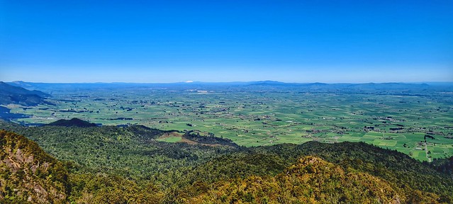
Looking out at the Waikato
IMG_20200912_201852_329
Remnants of the pylons

At about 4km in (and roughly 600m ascent), you reach the bushline and emerge into the open to an amazing view of the Waikato in front, the Kaimais stretching out to your left and Te Aroha to your right.  The climb is definitely worth it!  It was such a clear day that we could see the snowy peaks of Ruapehu and Ngarauhoe in the distance. It is quite exposed so probably not a great trail to do on a cold, windy day. We quickly cooled down in the breeze – the sun was warm but the air temperature with additional wind chill factor was bitter.

IMG_20200912_203251_630
257/366 12 o Mahuru 2020
Spot a snowy Ruapehu in the distance!
20200912_120829
Looking to the left at the Kaimai Range
20200912_121122
Looking right to Te Aroha

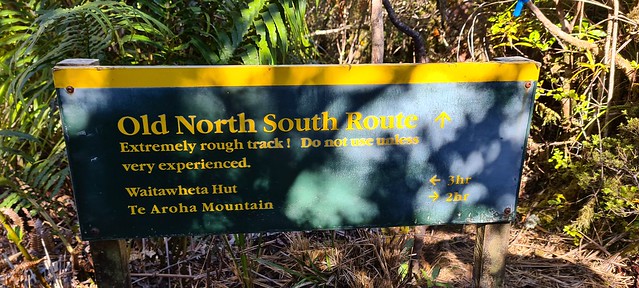
Continue to climb for a few more metres over more scrambly terrain to a rocky outcrop. This is apparently known as Pylon Peak. On the map there is a summit called Pahiko marked off to the right as you climb. There is an old sign and a path leading off to the right which is not marked on the map which I suspect takes you to the Pahiko summit but this description suggests there are no views from it. We carried on to the left heading towards Te Aroha. This is the Old North-South Route and it is pretty slow going to the junction. You do need to keep an eye on the markers but the path is mostly obvious just not very well-used so quite overgrown. 

You are following the contours now on the ridge so apart from a few undulations it is pretty flat. There were a few muddy patches to negotiate which could be challenging after heavy or prolonged rain. At this point I started to lose a little bit of confidence in my map reading skills and route planning – surely we should have got to the junction by now? We stooped to check the map – I had the NZTopo paper map and also brought it up on my phone so I could zoom in. I reckoned we had a little bit further to go but not far so we continued on. After about 5 minutes we rounded a corner and I spotted the green DoC sign up ahead. Phew!

20200912_130006
Somewhere in there is a Jo!

It was roughly 2kms to that T-Junction and then we headed left towards Te Aroha mountain.  The track is now much more runnable; there have been a couple of landslips which have been cleared which provide a clear view down to the valley. Pukekōhatu was my goal summit at 799m is to the right off the track as you run but sadly there didn’t seem to be a path leading to it and after spending longer than expected in the gnarly stuff we were keen to get running. 

20200912_132547
20200912_133010

We were running along the ridge still and there were some cool views between the trees. It didn’t take long to get down to Wairongomai Saddle junction running along more formed trails. For a longer walk you could turn right and climb the track Te Aroha but then you either come back the way you came or head down to Te Aroha domain and then another 7km or so along the road back to the carpark.

20200912_140851
Waterfall
20200912_141211-01
Tunnel

We went left to go down the tracks back to Wairongomai Road. This is the main Wairongomai Valley and you will start to see signs of the old rail tracks that are part of the network that fed the goldmines in the 1800s.  A phone torch is sufficient to light the way through a short tunnel and then you can pick whichever route you like to get back to the car park.

20200912_141657-01

We went down the side of the May Queen Incline, past the top of Butler’s Incline onto the High Level Pack Track and then on the Cadman Track and straight down to the car park. If you haven’t been this way before there are plenty of remnants of the goldmines and the tramways built to carry the gold to explore and wonder at. 

20200912_150309-01
Waikato Pasture and Kaimai Range

It took us around 3 and a half hours to the do the 15km circuit but we didn’t really stop except for photos and a bit of route finding as described above and we did run the 8kms from Pukekohatu summit down to the car park. The sign at the start of the Pylon track suggests 4 and a half hours to get to the North South Track junction and our friendly DoC guy was pretty surprised that we did the whole circuit in less than 4 hours. He reckons most people would take the 4 hours to get to the top and take a full day to do the full circuit. Having said that we’re pretty swift for a couple of ‘old nannies’!

20200912_123115-01
“Nanny Goats”

Day 12: Waipū

adventurecampervanlifecavinggeologyholidayleisureNZNZ Placestravelwalks

Caves and Beer

20200110_123337-01
Waipū Cave

The last stop on our roadtrip. Why? That’s easy… beer! McLeods Brewery to be precise! We have driven past here on many occasions on our way to hockey tournaments with Gus, we even stopped briefly once to have a look around. And the refrain “Waipū? Because you have to…?” is one that is chorused whenever the name of the town its mentioned! (Long story involving a van load of young male teenage hockey players!)

Since we have been avid followers of the NZ craft beer scene though, we have looked for opportunities to cost Waipū as it is the home of McLeod’s Brewery. Last time we came through it was winter and it was closed. Since then we had met Geoff in Kirikiriroa at Craft Hamilton and he had said to contact him next time we were in the rohe and make sure we called in. The pizza barn is very popular… I guess it was the height of the summer season but we had to wait to be seated even just for a drink! We ended up eating there too. Good pub grub but not a huge variety for vegetarians. Could do better on that score but the beer makes up for it! Disappointingly, when we went back the next day to get our carry out bottles filled we found that although they now have an “off” licence, they still don’t have the right gear to dispense so we went away empty-handed!

IMG_20200109_180844_859

While we were there we decided to explore Waipū Cave. It is just a few miles out of Waipū, along a gravel road that climbs up inland. We weren’t expecting how busy it was! It was great to see so many families there, kids barefoot and intrepid as they waded through the steam or picked a path over the stepping stones. Tourists of all nationalities venturing in with phone torches to light their way. Pockets of people switching off their lights and sitting quietly in awe at the glow worms.

20200110_114330-01
glow worms

Being intrepid, (and knowing caves!) we carried on through the stream as the roof lowered when everyone else stopped. We waded through the water which at its deepest reached our mid-thighs and soon lost the shrieks and chatter of families and found peace and quiet. After climbing over some breakdown boulders we arrived at a pool. There was a small passage leading on but it seemed a bit squalid and we really weren’t equipped to push on further! There had already been a few avens that were full of glow worms.

20200110_113039-01
glow worms
20200110_112936-01

We carried on exploring, climbed up to a higher level passage above the boulders and circled back round through rift passage to the main . chamber. We met a guy who had brought a group in and was playing hide and seek with them. He said he came in regularly with groups.

20200110_115810

On our way back out we noticed that to the right as you enter the cave there is another passage. Wide and lower than the passage to the left and full of water but with reasonable airspace. We thought we could see light coming in somewhere and had a quick explore to see if there was an aven that connected but couldn’t see anything, We went back to the van and saw a couple of groups coming back to the carpark who had clearly been swimming. Intriguing.

We headed off up the hill on a walk – just a wee walk but there was a good climb and great views from the top. We went past a heap of limestone outcrops which we explored on the way back down.

20200110_142401
20200110_143303
20200110_150700

Once we got down we headed across past the main cave entrance and round to where we had seen people coming from. There was another entrance (or exit!) – looking back neither Nigel or I can work out if there was any flow and if there was, which way it was going! We could hear the voices of tourists at the other end and I decided that it was too tempting not to swim through. Since it was only a few metres to the car and dry clothes, I took my shoes and socks off and headed in. I waded the first few metres until I reached waist deep and then swam. Slowly, steadily into the sem-darkness. The ceiling was just a half metre above me at the lowest point but there was mud and flood debris so it clearly sumps in wet weather. For a few metres, there is peace and quiet. I float on my back looking up at the ceiling just contemplating and remembering times when I sat at the bottoms of cave pitches deep underground. That absolute sense of being. Connected with the whenua. At one with but also ephemerally disconnected to nature. Then I turned over and swam on out to the noise of tourists happily exploring this natural playground. Part of me wanted to stay there and relish the oneness, I also love that so many people are experiencing a space that for so long was my life. It makes me want to get back and explore underground again. Maybe.

20200110_151703

Day 11: A bit of Northland history

adventurecampervanlifeholidayleisureNZ Places

R and R

It was probably time for a bit of R and R. We’ve done a few kms over the last week or so! 78.43km to be exact and 4,068m of elevation. Pretty impressive! So the next two days were pretty cruisy and since it was Nigel’s birthday, I thought I should cut him some slack!

We started by catching up with our old friends Chris and Ross who are currently living on their boat in Opua. They have bought some land in Kerikeri and have spent the last 6 months clearing it and exposing what is beneath the overgrown mass of weeds. They plan to build a house on it in the next couple of years. It was lovely to see them, catch up on all their news and see where they are living. Isn’t it funny how you can not see someone for years but pick up where you left off as if no time has passed at all?

20200108_124803
Kerikeri basin

They dropped us back of at our van at around 3pm and we decided to catch the ferry over to Korokororāreka (Russell) and walk up Flagstaff Hill. The flagstaff at the top is the one that was cut down 4 times either by or on the instruction of Hone Heke in protest against British sovereignty. It was a beautiful afternoon and we sat for a while at the top- another 100m of climbing! We were sat for a while just enjoying the views and the peace and quiet.

IMG_20200109_074020_939
Looking down at Korokororāreka from Flagstaff Hill

It did seem like an opportune place for a handstand….

IMG_20200108_183928_167

Then we walked up to the trig point and the information boards. I have read about the history of Korokororāreka before but actually being there makes it so much easier to understand and give meaning to the stories. Like any stories, it takes time and many readings and listenings for all the details to embed themselves and to triangulate the different perspectives. So, I will need to read more to gain a deeper understanding of the history.

But a trigpoint calls for a handstand….

IMG_20200108_183928_168

We wandered back down the hill into Korokororāreka and found a bar that served some decent beer and sated our thirst before getting the ferry back over to Paihia. A dinner worthy of a birthday was in order. We tried the Indian and Thai place that Ross had recommended but unfortunately it was absolutely chocker and incredibly noisy. We ended up going to Zane Grey’s – a pleasant meal that we ate sitting next to a large aquarium with fish swimming round in circles which was a little disconcerting! We have had better meals that were less expensive but we did discover a very nice wine that we have since found in our local wine shop for a third of the price!

Kawakawa

We had a lazy start to the day but were in no hurry. Our destination was Waipu and we had planned in stopping in Kawakawa to meet a friend for coffee. Unfortunately, she messaged to say that a kaumatua had passed and she would no longer be able to meet me. We decided to stop in Kawakawa anyway and have a wander and whilst there I remembered that Ruapekapeka wasn’t far away. I like Kawakawa, it has a real charm, not least of which is the railway that runs down the middle of the main street.

IMG_20200109_184612_608
Train on its way down the main street

It is also home to the Hundertwasser toilets which are fascinating but as a local said to me, ‘unnerving when you actually want to use them, and they’re full of tourists taking photos’! I did limit myself to a photo of the inside of the toilet cubicle whilst I was using the toilet. Although, I have been guilty of more than that in the past!

IMG_20200109_184738_152
Glass tile in the Hundertwasser toilet

We spent some time in the library/art gallery which had some beautiful pieces all well outside our price range! The children’s mural was delightful and I bought a bright summer dress in a recycle shop for $20 that I have since “upcycled”.

IMG_20200109_175951_000

We were tempted to go into the museum purely out of interest after seeing the advertising but decided that for a $10 entrance fee we weren’t that tempted!

IMG_20200109_183934_728

Ruapekapeka

Words cannot do this special wahi justice. You can listen to this RadioNZ or watch this documentary to hear the story. I plan to watch again now that I have visited the wahi and have a picture in my head so I might visualise more easily what happened. Māori dug an intricate maze of tunnels and trenches in which they sheltered as an army of British and other Māori iwi bombarded them for ten days. Then when it was clear they could withstand no more without losing men they withdrew into the forest behind. You can still see the remnants of the tunnels and look out at where the British had their base. On a hot, still summer’s day it is hard to imagine the violence, noise, fear and tension that must have reigned in this wāhi a century and a half ago. It was the last battle in the north.

IMG_20200109_185247_662
Depressions marking trenches or tunnels
IMG_20200109_185841_715
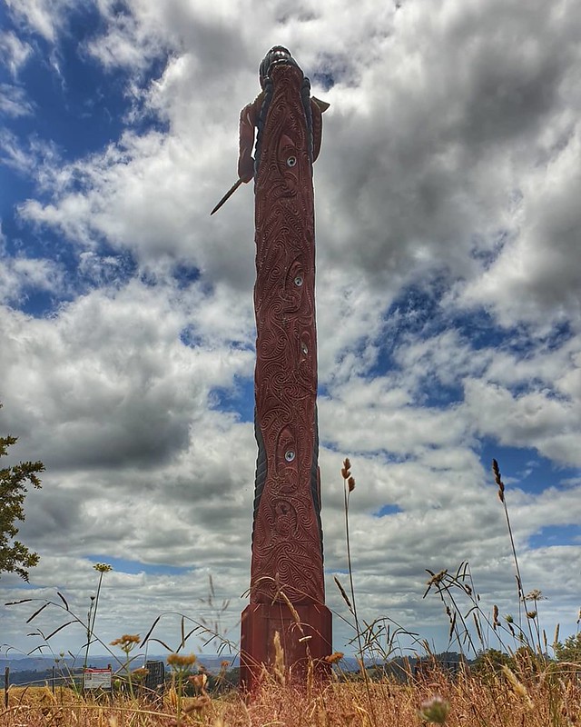
Pou at the far end of the pā where Māori would have escaped into the forest
IMG_20200109_185841_720
Old pou with new one in the background. The ground in between is riddled with afm intricate maze of tunnels and trenches.

We spent a good hour wandering around, getting a feel for the place, trying to understand the layout and how the battle must have played out. It’s incredible how nature reclaims places, reinstates peace and order, honours the lives of those who died and how somehow there is calm and serenity where once there was bloodshed and mayhem.

We walked back to the van retracing or steps over the British advance position on which you can still see indentations that marked battle positions. Then we headed southward to Waipū.

December Adventure

adventurefriendsholidayNZNZ Placestravelwalks

The plan; 4 adventurers, 5 days, 2 Great Walks

We hatched a plan sometime back in the winter when we were craving sunshine and adventure. Not that we don’t always have adventures but this one was special. We wanted to do the Heaphy Track but thought that once we had paid to get down there we might as well also fit in the Abel Tasman and get our plane flight money’s worth! The way the hut availability went meant that we needed to do Abel Tasman first and then Heaphy. The way that the flights worked out meant that we needed to travel down on a Saturday morning and come back the following Friday. A bit of a squeeze but we thought we could do it. We are fit and used to walking/running long distances.

IMG_20191215_072922_958

Sunday morning saw us waiting for the HeaphyBus to take us to Marahau and the start of the Abel Tasman. It was a beautiful day, we were ready to rumble. We had decided to get a good 10km under our belts before stopping for ‘Hobbit’s Breakfast’. This was going to be a long day as our destination was the Awaroa Hut 35km away.

20191215_093243
View from Abel Tasman Track, Marahau

Apple Tree Bay proved to be a beautiful spot to break for food. A cheeky seagull seemed to think that he needed some too! We found some shade and whilst the sea beckoned, I resisted as I didn’t want to get sandy and salty so early on in our walk! The weather was due to turn to rain by the evening so a swim was definitely planned for later in the day! Unfortunately, Amie already had a blister on her wee pinkie. This was unexpected as she is used to walking in her boots and doesn’t usually get blisters. She dressed it and we carried on.

20191215_102837

On we went, tummies and hearts full. What a beautiful place to be! Stunning views at every bend, birdsong, sweet smells of blossoms and great companions. Between Anchorage and Bark Bay we took a wee side trip up to Cleopatra’s Pool. Another inviting swimming spot in freshwater but pretty chilly. We wished we had more time to linger but we decided it was better to get a few more kms done before stopping for lunch.

20191215_123722

We crossed the Falls River by way of the 47m long swingbridge and carried on through lush forest. We were entertained on the way by quail and weka as well as fantails, tūī and other birds.

20191215_150413
20191215_150436

Onwards to Torrent Bay where we aimed to have lunch. It was teeming with flies when we went down to the boat ramp to get water from the toilets and look for a lunch spot. So we carried on and came around to another bit of beach that was much more pleasant. We put the stove on to make coffee to go with lunch. Couscous and salami for me with nuts and raisins for dessert. Our friendly seagull seemed to have followed us!

20191215_133505

From Torrent Bay to Bark Bay the track climbs up and over headlands, leaving the coast for a while. We could see down into the turquoise blue of the ocean, along the coastline and out to sea. It was so inviting as we sweated it out up those hills. Soon, I promised myself, just a little bit further until we are within striking distance of the hut. I didn’t want to slow everyone down by taking a break to swim. Cheeky weka popped up all over and kept us company.

Baby pecking weka #abeltasmannationalpark #decemberadventure #day1 #weckingpekas

We descended into Bark Bay and along the beach. Hot and awkward on our feet and Amie was really starting to feel it. Her feet were sore. The weather was starting to close in, the wind came up and the sky darkened. The threatened rain seemed to be on its way earlier than expected. Selfishly, I decided that swim time was going to have to be Tonga Quarry or never! As our pace grew slower, I said to Jo that I’d run on ahead and have my swim while the others came on behind. Jo came with me and then Paula and Amie carried on over to Awaroa as I got changed. It was a wee bit chilly as the wind was quite strong by now but once in the water it was lovely. I splashed about for a bit and then went to the freshwater stream to rinse off and get dressed. The beach at Tonga Quarry has shifted a bit since that fateful Christmas Day when Aonghas was helicoptered out after scalding himself. The stream was very low and may well have not been enough to cool his burns now as we did then.
Beach walking #memoriesofoxfam #abeltasmannationalpark #decemberadventure #day1
Onetahuti Beach

Paula and Amie had about a 20 minute headstart on us so Jo and I set off at a good pace to try to get to Awaroa Lodge not too long after them. We were still looking forward to beer and pizza! Up and over from Tonga Quarry to Onetahuti Beach was not as far as I remember but that trudge along the beach seemed to go on forever! Somehow the relentless climb up from the beach and over to Awaroa had been erased completely from my memory but maybe that’s because I’ve only ever been down it!

Last stretch before beer at Awaroa #onetahuti #abeltasmannationalpark #decemberadventure #day1
Jo on the bridge at Onetahuti Beach

Finally, we made it but sadly too late for pizza! We went into the luxurious Awaroa Lodge to look at the menu but decided the food was a bit rich for us after a day’s walking. We found a space outside in what ended up being the last of the sun for the day. Beer and bread and dips with chips went down well though!

Definitely earned this beer! #abeltasmannationalpark #decemberadventure #day1

It was hard getting moving again but it had to be done. Only 3km to go but it was slow going and we’d forgotten that we would have to cross the stream. We spent some time trying to find the narrowest part to avoid getting our feet wet but by now the rain had set in and it really made little difference! Those last few kms were done with heads down, one foot in front of the other at snail pace!

And the weather closed in as forecast. A dreich last 2km to Awaroa Hut #abeltasmannationalpark #decemberadventure #day1
Last stretch…Awaroa Hut is ahead of us somewhere!

It was good to see the hut and walk through the doors! We were the last to arrive and had to find 4 beds in amongst the bodies already collapsed on the bunks; we slotted in where we could, Paula joined the collapsed ones and the three of us set to tending blisters then making tea!

Day 2

Ready for #day2 #abeltasmannationalpark #decemberadventure #abitdamp
Ready to cross the estuary

Up and out early as we have to be at Wainui by 1.30pm for the shuttle. The tide times fell nicely for us as it was at its lowest at 6.45. We opted to wade across in jandals which was ok apart from the muddy sections when jandals stuck and the pull between my toes added to the grittiness was a tad painful! I remember last time I crossed the estuary I wore my walking sandals which was much better!

350/365 16th December 2019

We took the time to clean and dry our feet carefully and thoroughly on the other side before continuing. We made steady progress and were soon at Goats Bay. We had already shed our rain jackets as there wasn’t enough rain and it was quite warm. Now the sun was trying to sneak through the clouds. We were aiming to get to Anapai Bay before stopping for second breakfast which was about 10km. Amie trooped on at a reasonable click despite her sore feet and on the whole our spirits were high. We were, however, starting to wonder whether we were going to be able to do the Heaphy given the state of Amie’s feet and the impending weather conditions. Totaranui was our first gauge of the progress we were making – well under the 2h20 suggested by DoC and on target for shuttle pick up.

Light over the ocean #totaranui #abeltasmannationalpark #decemberadventure #day2
Totarunui – light on the water
Onwards to Anapai #abeltasmannationalpark #decemberadventure #day2
Coastal meadows between Totaranui and Anapai Bay

The section from Tõtaranui to Anapai provides a change of scenery and flora and the grey started to lighten. The lower level bush is softer but also more dense and despite the sun trying to break through, it was quite chilly.

Lunch stop at Anapai #day2 #abeltasmannationalpark #decemberadventure
Second breakfast at Anapai Bay
Looking down to Anapai Bay on our way to Mutton Cove #upandover #abeltasmannationalpark #decemberadventure #day2
Anapai Bay from track on the way to Mutton Cove

The track over to Mutton Cove and then onwards to Whariwharangi where we had scheduled our last stop rose up again and we had beautiful views down to the places we had left and glimpses of places we were yet to arrive at!

The sun has been trying hard to beat the rain... #whariwharangibay #abeltasmannationalpark #decemberadventure #day2 #lastleg #justupandoverthehilltogo
Lunch stop at Whariwharangi

Whariwharangi is a beautiful beach with huge pines behind it. The hut here is an old homestead with an interesting chimney. We stopped briefly for a snack but decided that we’d rather just push on. One more hill – the biggest on the trail – and then it was all down hill to Wainui. Just 5.7km to go! We had built this climb up to be more than it was! In the end it didn’t seem so bad and we found ourselves looking down at Wainui before we knew it!

Are we nearly there? #justdownthehillandroundthecornerandalongabit #abeltasmannationalpark #decemberadventure #day2
Are we there yet?
Our destination! #theendisinsight #wainui #abeltasmannationalpark #decemberadventure #day2
Nearly!

The problem with being able to see your destination is that it seems a long time coming. And so it was! But eventually we saw the waharoa marking the start and the end of the walk. We made it but not without sacrifice; Amie’s feet were a mess and there was a severe weather warning out for the next two days so later that evening we reluctantly made the decision to review our plan to walk the Heaphy Track. Plan B was put into operation!

We made it! Two days, lots of fun, lots of blisters, and so many farting quails and weking pekas #abeltasmannationalpark #decemberadventure #day2
We made it!

Day 10: Islands and Orca

adventurecampervanlifefriendsholidayleisureNZNZ Placestravelwalks

We were so incredibly lucky today! A friend from work picked us up at 9.00am from Rawhiti beach where we had stayed the night after our adventure yesterday. The Kaingahoa Camping ground is a great place to stay. It is clean and well-maintained. Margaret, who runs it is a bit brusque but once you get her talking, she doesn’t stop. Full of information about the history of the rohe. I emailed to book a place but it was never responded to, so I would recommend phoning. Fortunately, there was plenty of space on the day we wanted to stay! From reading the information on this website, it seems that the main building which is not accessible to campers, was the old Te Rawhiti schoolhouse but was used in the 1960s during renovations of te Rawhiti Marae as a replacement wharekai. The campsite revenue goes to the maintenance of the marae.

20200106_205357
Sun going down at Rawhiti

So, back to today! Tania and Scott picked us up and took us for a wee tiki tour around the islands. We stopped in at Otehi Bay on Urupukapuka Island for coffee and then we walked over the hill to Urupukapuka Bay campsite where they were staying with a bunch of friends.

20200107_103507
Walking over from Otehi Bay to Urupukapuka Bay

The plan was to find a sheltered bay where the kids could swim, while the boys went fishing. They plumped for Moturua Island and we cruised off over there in a selection of boats. Once on the island, we had a picnic, then the men went fishing and we stayed and went for a walk around the island before jumping in the sea for a swim. At Mangahawea Bay there is an archaeological dig going on. Evidence suggests that this place was inhabited more than 700 years ago.

20200107_132505
The archaeological dig at Mangahawea Bay

It was a lovely day out, meeting friends and generally just relaxing. The walk around Moturua takes about an hour at a leisurely pace in jandals! It is quite hilly though! The sea was delicious and it was nice to be able to swim with other people rather than on my own! The boys struggled with the wind on their fishing trip and Nigel was the only one who caught a legal fish so that’s what I had for my tea.

IMG_20200107_210841_989
Snapper for tea!

But the big excitement of the day was seeing orca. We first spotted a mother and her calf, and then a large male on our way over from Rawhiti.

20200107_092915
A mother orca and her calf

The male swam right under the boat and then surfaced on the other side. they cruised on along the way, two close together and the other just off to the side. Then when we were sitting on the beach in Urupukapuka Bay, they came into the bay itself. We spotted some splashing off to our left and then saw them swimming on out and around the headland through a gap in the rocks. Tania said that there had been stingrays and plenty of piper fish in that area the day before and so they had possibly come in to feed.

When we went out to Moturua we saw them again. Scott cut the engines and we bobbed about for a good 10 minutes just watching. They swam quite close but seemed to be happily cruising. They carried on out to sea and picked up a few more on the way. At one point we counted 7 fins in the water. Such a special and humbling experience to be in the presence of these beautiful creatures.

07/366 7th January 2020
Orca spouting

Warning: Attempt to read property "comment_ID" on null in /home/easegill/public_html/wp-content/plugins/subscribe-to-comments/subscribe-to-comments.php on line 81

Warning: Attempt to read property "comment_ID" on null in /home/easegill/public_html/wp-content/plugins/subscribe-to-comments/subscribe-to-comments.php on line 81

Warning: Attempt to read property "comment_ID" on null in /home/easegill/public_html/wp-content/plugins/subscribe-to-comments/subscribe-to-comments.php on line 81

Warning: Attempt to read property "comment_ID" on null in /home/easegill/public_html/wp-content/plugins/subscribe-to-comments/subscribe-to-comments.php on line 81

Warning: Attempt to read property "comment_ID" on null in /home/easegill/public_html/wp-content/plugins/subscribe-to-comments/subscribe-to-comments.php on line 81

See previous posts

Categories