Category: holiday

Time for a hill!

adventurecampervanlifefaunaholidayleisureNZNZ Placestravelwalks

Day 3: Hauturu Highpoint via Six Foot Track

20191231_122747-01

We woke to a clearing sky which was good news as we had planned on walking up the Six Foot Track to Frampton’s Hut and then to Hauturu Highpoint. According to DoC and the TramperNZ blog the views northwards across the Hokianga and southwards to Waipoua are stunning, so we needed a clear day. 

20191231_100923

The track goes from the end of Mountain Road, which is about 3km north of Opononi. It is metalled but well-maintained and Vera made it easily.  Just before the sign that says the road is no longer maintained past this point, there was a place that offered space to camp (Okopako Lodge) – looked like an amazing spot so one to bank for another time we are here. We continued to climb up the windy road for probably about 3km until we went past a few habitations – I hesitate to say houses as most of them seemed to be old caravans or sheds grouped together. Off to the left down a driveway did seem to be a real house – very grand it looked too.  Just a bit further on the road widened and it was clear it was the end of the road. We could see the DoC sign ahead.  There is space for possibly one or two vehicles if you tuck in but it is also the turning space for the people that live in the houses here. 

20191231_102837

We spoke briefly to a man and his two children who were there and checked it was OK to park. 

The trail climbs gradually as it traverses along the slope through the forest. It was pleasantly cool, easy underfoot though there were some boggy sections as the path crossed streams. I suddenly realised that the sound I could hear was cicadas. Summer is here! My first cicadas of the summer – such a heart warming moment! The track is an old bridleway and you can see that it is slightly raised with clear edges for the most part but there are areas where erosion has narrowed the trail and the drop off to the edges is quite steep. 

20191231_104432-01

We soon arrived at a gate that marked the junction where the 4WD track to Frampton’s Hut veered off from the main trail up to the Waima Main Range Track and Hauturu Highpoint. Another ten minutes on along a narrower path and we were at the next junction. Right to Hauturu and straight on to follow the main track. 

20191231_112321-01

Now we started to climb! Steep and rugged in places, we made good use of trees, branches and roots to help us navigate the muddy, Rooty slopes. The forest changed as we climbed. I really need to learn my trees and plants better so I can know what I am walking through!  Suffice it to say that the light through the trees dappled the way and whether it was Nikau, Manuka, Rimu, Totara and any number of ferns and mosses, it was beautiful. 

20191231_104353-01
Vegetation Window

The steep ground levelled off a bit and although we were still climbing it was a bit easier. We emerged into a clearing where there was a meadow of Oxeye daisies, buttercups and grasses. A sign warned to keep dogs on a lead because of sheep grazing though we saw none. It was tempting to stop and have our picnic but we decided to continue to the top.  From here we climbed to a ridgeline and walked along it for a while, steep drops on either side of us. I thought that if this were Scotland or the Lake District, we would be feeling decidedly exposed.  Ridgelines in forests are not nearly so intimidating but nor do you get the thrill of feeling high up and being able to see all around you. I am not sure if the glimpses you get through ‘vegetation windows’ are more tantalising or just frustrating! 

20191231_112652-01
Meadow

Then we started to descend – quite a long way – and I was unsure if we should be going down so far. However, the time and distance we had travelled didn’t fit with having reached a summit and neither did any signs. Surely there would have been a sign!? I peered myopically at the map and thought I could see that the track did cross some contour lines down to s stream and then climb again. From memory that was what we had decided when we had looked at the map with glasses on! But I wasn’t sure so I turned around to climb back up to Nigel. He had also questioned his memory and was unsure. Nigel had the brainwave to take a photo of the part of the map we needed and then enlarge it so we could actually see the contours and confirm that we were indeed in the right place! 

20191231_130647-01

The climb up from the stream was again very gnarly and steep but not very long and we were soon at the sign (there was a sign!) that marked the way on over the hill to Waiotemarama and the dogleg off to the Hauturu Highpoint. It was almost a disappointing summit.

20191231_112753-01
View from the summit

A large wooden trig in an almost clearing reminiscent of Maungatautari. Trees had clearly been felled to provide a lookout to Hokianga but they had grown again and partly obscured the view. I climbed up the trig to get a view but still had to crop it to get rid of the tree that had grown and was in the way! I spotted another orange marker pointing on past the trig. Leaving Nigel at the trig I followed the trail.

There was the view! This is when those tantalising glimpses that build a bit of a picture in your mind are worthwhile … the surprise of a full view is all the more spectacular. I ran back to Nigel and he followed me out to the lookout. We could see the Waima Range heading off to our left, the Waipoua Forest in front of us and to our right glimpses of white sandy beaches. Beautiful. 

20191231_122808-01
The view south to Waipoua Forest

There was a trig – and trigs need handstands!

20191231_123858_014-01

The trip back was, well the trip back. All that we had done, but in reverse. The downs didn’t seem so extreme as we had thought they might be when going up them and we were soon down to the meadow where we had thought we would have lunch. Too hot and too exposed so we continued on to Frampton’s Hut.

20191231_134506-01

What a wee gem! Nestled in a clearing in the forest, the hut is an old farmstead with a verandah and a chimney and a pot-bellied stove.  We explored than had a leisurely lunch on the verandah before finishing off the last section down to the van. 12km (I did a bit extra going backwards and forwards to Nigel) about 3 hours moving time but about 5 hours all up including stops and meanderings! 

We treated ourselves to an Affogato in a cafe in Rawene – new since we were last here – and looked at the artwork then wandered around the village before heading back to Opononi. 

Hogmanay here we come! 
Pootling

adventurecampervanlifeholidayleisureNZNZ Placeswalks

Day 2: Heading further north

Sunday evening Dargaville is a ghost town, but on Monday morning it awakes with a bang. By 9.00am the carpark was filling up, the main street was abuzz, cafes were chattering with late breakfasters and those of us getting our caffeine hit.  BlahBlahBlah was our choice of cafe and that of most others by the looks of it. Definitely worth a stop if you’re in the rohe. The weather seems to have taken a wee turn for the worse and it is cloudy. The sun tries to break through at times during the day but the rain is always threatening and brings with it a bit of a chill. 

IMG_20191230_183128_695
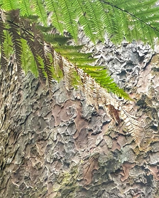
Kauri Bark and fern

We stopped at Trounson Kauri Park on the way to Hokianga. We stayed here once before and sat out in the bush on a star-studded night on the lookout for kiwi which we heard but didn’t see. It is a beautiful bit of forest where kauri trees tower without dominating and provide space for other trees and bushes to thrive. We meandered our way along the boardwalk enjoying the cool freshness under the canopy of trees. The boardwalk has been installed since we were last here presumably in response to the growing threat of Kauri Dieback Disease which is decimating kauri trees throughout the forests of North Island.  The process for getting people to clean their footwear before entering the forests is much more streamlined and efficient. There is some question as to whether human foot traffic is to blame and whether going to the effort of cleaning our shoes will do any good at all when forest animals wander at will spreading the spores. However, we reflected that at least it raises awareness of this important issue for New Zealand biodiversity and the protection of a tree that is iconic in Aotearoa.  Several other footpaths in forests in the region are closed indefinitely due to the disease, so at least we still have the opportunity to see these majestic trees at the moment. If the measures in place enable us to continue to enjoy them then that;’s all good. 

IMG_20191230_182400_407
Fern
IMG_20191230_182042_766
Giant Kauri Trunks
IMG_20191230_182918_316
Bush Lawyer

The clouds darkened and it turned colder. Rain was on its way. We were ready for lunch but decided to carry on rather than stop for more walks. We pulled into the layby that looked out over the Hokianga Harbour and Opononi and had lunch while we decided what to do about where to stay the next few nights. The lookout at the headland was a possibility if freedom camping was allowed, otherwise we needed to see if any of the holiday camps had spaces.  

Lunch with a view! #atthetop #roadtrip #campervanlife #summerholidays #exploringnz
Lunch with a view over Hokianga Harbour

We drove along to the headland to find that we couldn’t camp there so turned back and stopped in at Opononi where there was space. A bird in the hand is worth holding onto so rather than carrying on we booked in. It’s a family-friendly campsite overlooking the harbour. Everyone seems friendly and it is clean and orderly.  It will be interesting to see what happens on Hogmanay!

The rain and cloud blew in in waves up the harbour from the sea and so apart from a wander down the road to the pub for a beer, we stayed at the van, made tea and settled in for the night.

20191230_184005
Opononi Beach

Summer Roadtrip 2019

adventurecampervanlifeholidayleisureNZNZ Placestravel

Northwards Bound

Day 1: Travelling North

Destination: Dargaville

Detours: purchase of raspberries at a roadside stall 

Arrival: 5pm-ish after 5 hours on the road. 

20191229_165140-01

I like Dargaville. There’s something about it. Arriving on a Sunday evening, it’s a bit of a ghost town. Nothing open bar a few fast-food places. Streets empty. The buildings tell of a former bustling metropolis – grand stone/brick buildings with big windows, faux pillars, carved stone work and dates and names importantly etched but eroding now as time and the weather do their stuff. Paintwork too is flaking to reveal the natural stone and wood beneath. 

20191229_164400

The names of the shop owners tell of the heritage of the gum diggers who came from Dalmatia in the 19th century to seek their fortune or simply a better life. We buy chips from Matich’s fish and chip restaurant and just a few doors down is  Matich’s clothing store. Same family? Probably. I have no idea if they are related to this venerable gentleman. They are good chips for the record. We ate them down by the river on the boat jetty. We wondered what sort of boat pulls in there – it’s tall and the guiding poles are specifically positioned. Nigel did a Google search and found that there is a two day excursion from Helensville to Dargaville that retraces the old steamer and sailing ship routes.

20191229_164146-01

I remember the river from the times I have been here before. It cuts a wide swathe through the landscape of murky, muddy brownness, flowing rapidly but thickly out to sea. I seem to remember that large sea going vessels used to ply their way up it to trade which made Dargaville the important and busy place its was. Somehow, sometime the deep channel silted up and the ships can no longer navigate safely. Or maybe the nature of the ships changed, the different trading needs, the viability of gum and other local produce was compromised? 

After our chips ‘to put us on until tea time’, we drove out a bit to see if there was anywhere else to camp up for the night. The carpark was a possibility but there was still time and light to explore.

We drive past fields of kumara – this is the “Kumara Capital of NZ” after all – as well as the odd field of corn. The land is flat so we can see for ages but there are also hills in the distance.  Past small villages that remind me of the one street towns in France; houses either side of the road, a church, a couple of shops, guest houses, maybe a cafe or a garage. There is a house with a garden full of … I’m not sure what…. Piles of coloured stones and gnomes…! A run-down place with weather-beaten, lichen-encrusted signs boasting ‘natural crafts and Christian products’ – the mind boggles!  Here, there is not just one church but one for every denomination – Church of the Latter Day Saints, a Presbyterian / Methodist combined church, Anglican, Catholic and one unidentified! 

20191229_172350-01

We didn’t find anywhere to park but we enjoyed the drive and stopped on the way back at a ‘walk in park’. For the princely sum of a $2 kohl you are invited to explore Ernie’s garden. What a cornucopia of crap and quirky creations nestled in a neatly mown strip of field, planted with flowers and native trees! We had fun sitting on the ‘Gumdigger’s Bum’ and then marvelling at the piles of rusty rubbish. It made me think of the old engine parts, household appliances and farm machinery that lie rusting in farmers’ fields the world over. Instead of leaving it in a field, Ernie has carefully arranged it in not quite artistic piles, framed things in a weird and wonderful context with very definitely ‘Dad humour’ jokes and enterprisingly charges $2 for the privilege of viewing it! To be fair, some of the creations are quite clever! We particularly liked the ‘bottle trees’ made from old telegraph poles and bottles. The large kiwi woven with fabric and wooden lattice was clever. 

20191229_174715-01
20191229_174425-01

The jewel in the crown, though and really the only thing really worth seeing and marvelling over was the smallest church in New Zealand. It truly is a work of art. Made of repurposed swamp kauri it has two pews that seat 4 or 5 each, an altar and a font. Its steeply vaulted roof is topped with a bell and two crosses and the gables are adorned with two beautiful, locally made stained glass windows. A white picket fence encircles the church and a rose-covered pergola arches over the gate.  Our $4 was well-spent. 

20191229_175252-01

A Caving Trip!

cavingfaunaholidayNZNZ Placestravelwalks
IMG_20191219_171325_694

Plan B, Day 2 – a bit of an adventure up the Maitai Valley. Starting at the Maitai Dam, this trail took us for 3kms or so along a really runnable, undulating trail.

IMG_20191219_165846_349

Then we hit the river, which we had to cross! Knee deep and about 15ft wide with freezing water! The trail from here on in, as described in the guide was very gnarly, lots of tree roots, narrow, greasy and at some points the stream flowed along it. So we sloshed our way upwards as the path climbed through beautiful woodland.

IMG_20191219_170506_781

After a couple of kms (less than the signs indicated) we arrived at Maitai Cave.

IMG_20191219_170506_806

I ventured in to explore while Jo and Paula waited outside for me. I could hear the stream from above and it sounded like there was quite a lot of water. Difficult to see initially how far down the climb was to get to it and how much of the passage it filled. I clambered down greasy, muddy boulders making tentative use of the rope that was belayed around the rock that wedged across the entrance.

20191219_111403

Landing in the ankle-deep stream at the bottom I could see that it emerged from a small opening directly ahead of me. I looked to my right first to see what was there but after a few steps saw that there was no way on. I ducked down and could see that it was possible to get into where the stream was emerging. I crawled into a short passage that only went a few metres. the water seemed to be coming from under the rock wall.

20191219_111307

On coming back out, I followed the stream (all of 2 – 3 metres!) to where it disappeared underground – a couple of tree trunks were wedged in the stream.

20191219_111803

Turning around to my right, I looked up and saw that there were more boulders with a piece of tat hanging down. Above them was an aven. I climbed up, inspecting the rope carefully as I may well need it to get down again. The floor was strewn with large boulders, mostly covered in greasy mud and knowing that Jo and Paula were waiting outside I decided not to go any further. It didn’t look like there was a way on.

20191219_111600

Shining my light upwards I could see that the aven was about 30 ft high but difficult to see if there were any stals. Apparently Maitai Cave is the home to a very rare snail but I couldn’t see any pools that it could have been in – all water I saw in the cave was flowing quite fast!

IMG_20191219_171325_698

I was quite cold by the time I clambered out, very muddy and wet! We made our way back down through the forest. It really is a beautiful trail. The river flowed on our left and we soon came to a point where the path met the river and by then I was warm enough to give myself a bit of a wash and get rid of the bulk of the mud!

IMG_20191219_170506_792

It took us about 2 and a half hours in total to do the 11kms and 20 minutes or so of cave exploration. The sign at the start says it is 13km and will take 5 hours. However, we did run all the runnable parts (approx 6km).

Campervan Adventures Part 2

campervanlifeholidayleisureNZNZ PlacestravelUncategorized

It’s been a while since we started our adventure driving Vera north from Christchurch. I don’t mean we’re still driving, just that I haven’t got around to continuing the story!

Where were we?

We awoke to a beautiful sunrise on the Kaikoura coast. Vineyards and rolling fields took over from rugged coastline as we drove towards Picton. Made a brief stop in Blenheim for a cup off tea with one of my colleagues, lunch in Picton then onto the ferry.

An uneventful but always beautiful sailing. The scenery is stunning especially as we sail through Queen Charlotte Sound but it was a bit chilly on deck so after a while we made our way to a sunny spot in the bar!

Onwards then to Silverstream where we parked up at Chris’. Somehow I needed to get in at least a 3km walk/run as I was taking part in a ‘March run streak’ which meant I needed to run everyday in March for at least 3km! The offer of wine was tempting but it would have to wait until after a run. I managed my fastest ever 5km run… nice and flat along the Hutt River! Then it was time for wine, dinner and a catch up with all Chris’ news.

We spent the next day at Nethui combining work with pleasure and plenty of opportunity to walk as we got the train in from Silverstream and then walked along the front in Wellington to Te Papa. It was a special copyright edition of Nethui with a keynote by Cory Doctorow. But more of that elsewhere.

We headed north the next day on a wee tiki tour of central North Island taking the opportunity to visit some places we hadn’t been to before as well as some old favourites.

Foxton; a visit to the Dutch windmill and a picnic on the windy beach accompanied by scavenging and very bold seagulls!

Taihape; quick coffee stop in the old post office which is now a cafe. New Zealand’s clock towers are an interesting study; they all seem to be of a similar vintage, equally ugly but strangely charming!

Taupõ; on our holiday in 2005 we stopped on the shores of Lake Taupõ for a cup of tea in the campervan we had hired. Where better to take a break after a wee walk in the bush to get my 3km run in!? Blackberries as a bonus too!

After a brief stop in Taupõ itself to get dinner we set off on the last leg home to Hamilton planning our next trip on the way.

Adventure in Mo’orea

faunaholidayleisureMooreatravelwalks

So, Nigel and I have escaped for a real holiday. Overseas, together, just the two of us. I feel a song coming on! No, sorry, I won’t even go there!

Anyway, we’ve run away to paradise. Tahiti. I might write some other blogs to tell you about what we’ve been up to here, and our photos will all be on Flickr as usual.  But this evening’s blog is just to recount the adventure we had today.

Our plan for our time away is to be as active as possible. Two reasons – one, we just don’t like sitting around sort of holidays and two, we’re in training. I’m running the Abel Tasman trail event in two weeks time so just need to keep my legs moving and, in January we are both doing the Old Ghost Road.

We explored what guided walks were on offer so that we could learn about the local flora and fauna and history. We couldn’t find any that went on ‘real’ walks although we were given the number of a local ‘sage’ who we tried to contact but were unsuccessful.  Undaunted, we decided to go it alone.

Mark, our host at our accommodation, Mark’s Place, told us that a well visited view point called Les Trois Cocotiers (three coconut trees) was accessible by a less well-travelled route from just a few kms around the road from us at Vaianae. It is also possible from Les Trois Cocotiers to continue on to Le Belvedère which is where most people walk from.  Our plan was to try to get across to Le Belvedère and then return by the same route.

Mark dropped us off at the start of the metalled road just a few metres further on from the shop at Vaianae. He gave us some basic instructions as a starting point but told us to call in at a place called “La Maison de la Nature” and introduce ourselves and say that Mark had sent us. They would give is more detailed information about the route from there.

On the way we chatted to a local who confirmed what Mark had said; it would take us about an hour and a half to reach the col and then a further 90 mins to get to Le Belvedère. However,  unlike Mark he said the route was quite straightforward and well way-marked.

The first 30 minutes climbed gently up a metalled road past houses which varied from being simple dwellings, with gardens full of fruit trees, chooks and dogs to more lavish houses with well-manicured gardens. There are dogs everywhere here.  Even though they bark they tend to stay put even when there is no fence but I still find them alarming.

Man walking up metalled road palm tree to left, lush vegetation all around, cloudy sky but sunshine.

Our first challenge came when the road split. One way went over a bridge and then turned sharp left up the hill. At the bend was a white house. The other road turned left up the hill and it seemed to be the continuation of the road we had been following so we took it.  About 100m higher up there was this sign;

Hand drawn map of local roads showing where people should be to start a walk

It might have been more useful to put it at the junction!  So back down we went,  over the bridge and up the rougher road.  Ten minutes or so further on we came to a building.  By this time the road was more overgrown,  the trees much thicker. There was a sign but it only had a phone number on it.  It looked like the whole place was being renovated.  To the right we could see a large shelter with a sort of climbing wall.  We climbed the wooden stairs which kindly asked us to walk ‘doucement’ to a balcony where a pair of jandals sat on a mat. We called bonjour,  but got no answer and didn’t feel that we should walk in so we continued up the track.  However, it went past an upper entrance to the building where a man was working a saw of some description.  We introduced ourselves, said we were staying at Mark’s Place and that he had said to call in.

His instructions were as follows.  Continue up the path,  at the windmill turn right,  continue on until you get to a stream. There used to be a bridge but it’s broken so just follow the track across the stream then turn left.  Keep going to the col. At the col, head left for about 10 minutes to the viewpoint where you can see north and south.   It should take about 45 minutes. To carry on to Le Belvedère, go down at the col for about 20 minutes or so then the path traverses, meandering up and down through beautiful terrain.  Roughly an hour to an hour and a half. ..

Off we went. No sign of a windmill (We saw it on the way down) but a junction of sorts – the single track path through knee high grass was clearer to the right.  Then we spotted a sign post hidden under the tree.  Confirmation.

A windmill in bush area with a mountainn in the background

Old signposts with indistinct writing attached to a tree

Reminders that La Maison de la Nature used to be, and may well be again, a ‘Colonie de Vacances’ for children lay half buried in the grass and vegetation.  Rope swings, balance beams, stepping stones and other adventure challenges. We came to a waterfall at a stream with a broken crossing but not what we would call a bridge and there was no obvious way on.  From the way the description had been given, I didn’t think we should have got to the stream crossing yet anyway.  So we looked for another way on and found a grassy track heading up to the left. It wasn’t well-defined but it was definitely a track and there were more kids’ adventure type obstacles half buried.  Convinced we were on the right track we continued.  Until a fallen tree seemed to block the way.  Maybe not,  we thought, and went back down looking for another option.  But not finding anything we went back up again.  The fallen tree negotiated we refound the path. A little further on we started to descend gently on a grassy slope, back to a single track in knee high grass.  A junction gave us a choice of continuing down or turning sharp right.  A rope looped between wooden posts helped to convince us that this was the right way.

Now we came to another junction.  A wide grassy shelf headed up gently to the right, to the left, a narrower steeper path.  I went up it to recce. It seemed to continue on as a well defined path, but we weren’t sure it was heading in the right direction.  We tried the other way. After 20m or so, there was another wooden activity challenge but then the path seemed to head back down in a loop.

Man walking in forest, heavyvvegetation, lush and green

We decided to go left.  On we climbed.  The path was rugged, steep at times, very rooty with quite a lot of fallen vegetation and we had to keep our eyes peeled to stay on track but it was clearly a path. All the way up were had enjoyed the changing vegetation, the lush tropical plants – the sort that I once had as house plants in my bedroom as a teenager in the 70s. The colours are beautiful,  bright red hibiscus in the trees around us and also splashes of colour on the path where the blooms have fallen.

Mountain shrouded in cloud seen through forest

The path started to climb more steeply and through the trees we glimpsed the impressive tall rocky peaks, half shrouded in mist. We were still waiting for the path to turn right and eventually it did. After having spent the last half an hour on a ridge we descended into a bowl of trees. Quite different, dark but not foreboding.  We were still searching for the way on when we suddenly noticed the trees.  Tall, incredible buttress roots, gnarly and twisted into the most surreal shapes.  We marvelled at them,  realised these were the chestnut trees or Mapes that we had read about, and thought about sitting down and having lunch.

twisted buttress roots of chestnut tree in a forest

Man in the middle of a forest of tall trees, sunlight shining through the branches

We decided we couldn’t have far to go by everyone’s timings so thought we would press on.  Despite thinking that we needed to stay right, we weren’t happy that right took us down hill.  So we went left,  uphill thinking it would swing back round.  After bushwhacking our way through more fallen trees and rotting vegetation up an indistinct but definite path we came to a stream and small waterfall which we crossed.  We were clearly climbing higher,  the canopy was lighter,  we could see the sky.  Surely we would hit the col soon!  I battled my way up and got to a point where I could see down to the ocean on the west side of the island.  But just more forest behind me.  A path alongside a stream led us up to an impressive black wall of rock with a path to the left.

Black rock wall with hollowed out area at the base, and a stream bed running down towards the viewer, fallen trees across the valley with new growth growing upwards from horizontal trunks

By now we were well past 45 minutes.  This was not an easy route.  We seemed to be heading in the wrong direction. We must have gone wrong way back down at the ‘shelf’ when we chose to go left and not right.

We turned round.  On the way down we noticed slash marks on the trees. In NZ in the back country, hunters and bushmen mark the trees to help them back track.  We started to think that we must have come across the traverse route from Tuatapae which we had read about.  It didn’t take long to get back down to the Mape forest where we spent 15 minutes or so just checking that we hadn’t missed a way on.

Feeling quite weary now and very frustrated and annoyed that we had missed a turn off somewhere, we knew we should really eat to put some energy back in our bodies. We had been bashing through the bush for over an hour but were reluctant to stop until we knew where we were.  So, we retraced our steps. Back down to the ‘shelf’ in no time. As we had thought the first time,  it simply looped down to the waterfall. I crossed the stream and climbed up the other side.  An unlikely route as it was not easy. The stream that fed into the waterfall bounced over dark rocks and I scrambled over and through but could find no easy path.  I heard Nigel call me.

white fungi growing on a fallen tree

Just a few metres back down the track he had spotted some bits of wood.. broken structures of some kind which he assumed were more of the kids adventure stuff.  Looking the other way,  a track down to the stream was more obvious and Nigel then spotted more wooden debris.  The broken bridge

stream bed, foliage and broken wooden structure in the streambed that used to be a bridge

We were back on track! With renewed energy we set off up the much easier, open track.  Still quite gnarly,  lots of trees roots, the path zigzagged up the flank of the hill, the stream gurgling beneath us.

A few very rickety bridges were crossed very gingerly and a couple of fallen trees negotiated. But it was well signposted with Xterra race markers.

man wearing walking clothes - hat, shorts, tee-shirt waking gingerly across a rickety wooden bridge

35 minutes later we reached the col!  10 minutes after that we looked out north and south at the coast and along the ridges at the peaks shrouded in cloud.  Stunning! Worth the effort! And time for lunch.

signpost that reads "le col tetoatoa dit des 3 cocotiers alt 357m'

Man on top of a hill with more hills in the background.

A couple at the top of a mountain, clouds gathering atop a mountain in the background

Panorama of a view of mountains from the top of a hill

Man climbs the last few metres to the top of a hill. He is just emerging from the vegetation. Hill shrouded in cloud behind him

Down was uneventful.  And quick.  Despite stopping to take photos of the abundant, colourful and beautiful flowers on the way. We called into the Vaianae store for refreshment…a nice cool Hinano beer, and we trudged the last 3km back along the road.

Total kms: about 15km!

Total elevation: more than 500m!

Total time on feet: over 6 hours!


Our first adventure; Part 1 Christchurch to Kaikoura

holidayleisureNZNZ Placestravelwalks

So, we flew to Christchurch and met ‘Vera’. Although I had bought her just a few weeks ago, I have to confess, I was a little worried that I might have been sold a pup! It all happened so quickly.

Nigel: There’s a camper van in CHCH, see if you can arrange to view.

Anne: OK.  Contacts vendors, they bring it to my hotel, I look around it. Test drive it around Christchurch on roads I don’t know, scared to go too far in case I get lost! Decide the vendors sound legit, WoF and history seems ok, bit tatty, but engine seems fine, drives ok. Deal done! Money transferred. 24 hours later, they deliver it to work. We are the owners of a 25 yr old Toyota Hiace camper van!

Now what? Well, I won’t go into the details of driving the wrong way up a one way three lane street, nor the narrow missing of a huge boulder rolling down the hill and landing on the other side of the garage where we parked the van for safekeeping for a few weeks.

We’ll start the story as we head north with our new acquisition.

Part 1: Christchurch to Kaikoura (the naming of names)

Camper vans have to have names. Don’t they? So my friends say, anyway. And my Dad always named his cars. Kevin, who looked after the van, whose own car even more narrowly missed being hit by aforementioned large boulder, has two very tiny, very cute dogs. One of whom is Vera. Seems to fit! Nigel isn’t sure…

Pandas also need names. Not entirely sure what panda’s history is but he (she?) came with the van.  On the way north we stopped for coffee with the rellies. They had a tour of the van and when William asked what Panda’s name was, we asked him to do the naming honours. Pete it was. Pete the Panda.

Panda soft toy looking out of a white campervan
Pete the Panda

Apart from the coffee detour we also had a whiskey detour. Who would have imagined a whisky distillery in the middle of suburban Kaiapoi? We didn’t, but it would have been rude not to have called in! And even ruder not to have bought any!

The Kaikoura coast really has been decimated. In 2016, it was the centre of a magnitude 7.8 earthquake which pretty much cut the place off.  Subsequent ‘weather events’ have undone some of the remedial work that was done on the roads and when we drove north, it had just been re-opened, albeit with a curfew.  Access was only in daylight hours, – 7 am to 7pm.  The landslides and the damage to the road and coastline are incredible and progress is slow with lots of the road operating one way only with traffic lights or Stop Go signs.  It has been difficult to imagine what the road looked like from the constant news articles, and I think that it is worse than we ever thought.

mountain landscape in the background, repairs being made to a road, cranes and diggers working on the road. Bottom right hand corner is the reflection in the wing mirror of the car of the photographer taking the photo.
Roadworks

We stopped at Kaikoura itself for a break and a wander along the seal colony. It is 13 years since I was last there and so memories are a little hazy.  But we saw plenty of seals basking like large slugs in the sunshine. However, there is evidence of the earthquake apart from the obvious shift of the level of the coastline. In one section of the trail, we noticed skeletons of young seabirds, in situ, seemingly in nests. It was quite eerie. We have struggled to find any documentation specifically and it may well be that these are victims of a weather event subsequent to the earthquake.

skeleton still with feathers of a seabird nestled in the remains of a nest in the white pebbles on the beach
Young seabird skeleton: Kaikoura

man wearing a red tee short and shorts walking across the rocky beach area at the coast. Mountains in the background with wisps of cloud in front of them.
Nigel at Kaikoura

folded white rock whic looks like it is waves. A single windswept tree stands on the horizon on a hill

As 7pm drew close, we needed to make it off the road. The NZ Campervan Association manual told us that there were several possible overnight campsites along the road. Unfortunately, it didn’t tell us that they were no longer available because of the damage to the road. Maybe because the NZ campervan association is almost entirely analogue and so can’t easily update. However, eyes peeled we scanned the coastline and soon saw the telltale white of another van parked up close to the beach. The railway track was now conveniently on our left and so we easily pulled off, followed our noses and found a sweet spot right on the beach. We nudged Vera backwards so that we could open the tailgate and have a view of the ocean. Set for the night.

Sunset, fire, sleep, sunrise. Magic. #campervanlife

panorama of the sunset over a beach.

fire on the beach with a glass and a bottle of whisky in the foreground
Fire and Kaiapoi whisky – sweet combination

sunrising over the ocean, turbulent waves in the forground


Heading into winter…

AonghasHamiltonholidayleisureNZNZ Places

So we’re settled into our new house, started to get to grips with the garden – even bought some plants, a shredder to mulch the prunings and the falling autumn leaves.  We have plans to create a veggie plot and swap some of the decorative perennials for fruit trees.  Aonghas has already planted some carrots and marigolds ( or marlegods as he calls them!) in the boxes outside his window.  The early Camellias are starting to flower and we have a carpet of deep pink petals in our garden.  Roses are still blooming but the trees are wearing their autumnal colours and looking glorious in rich shades of yellow red, red rosethrough orange to red.

Well, what have we been up to..?  Boys have finished summer sports and are training for their chosen winter sports.  Lachlan is continuing with rugby, but has taken up squash and, as he is in Year 10 he is allowed to use the weights room at school.  Aonghas has decided to try hockey this year and is enjoying that – he even scored a goal last week!  Lachlan is also running regularly and still cycling.  Next weekend he is heading to Rotorua to take part in the Moon Ride – a 12 hour mountain biking marathon.  He is riding as part of a team and they will take it in turns to do the 15km circuits from 10amAonghas playing hockey to 10pm.  We were down there a couple of weekends ago and all had a go on the tracks. The Redwoods is a great forest with masses of mountain bike tracks of all levels.  Aonghas coped really well with them and ventured down the Dipper which even I braved, though Nigel decided that caution was the better part of valour and chickened out!  (we won’t hold it against him!)

We were down in Rotorua as I was taking part in a Duathlon, we decided to make a weekend of it as it was the last weekend of the Easter holidays, and our friends Liz and Chaz were also there with their boys, Jamie and Josh.  Liz was competing in the Duathlon too, as well as a couple more of our friends.  We stayed in the Thermal Holiday park – the same one we stayed in when we Aonghas on the "Dipper"were here on holiday in 2005. We rented a self contained unit which, in estate agent speak, made good use of space – compact and bijou!  The advantage of the park are the hot pools, plenty of running around space for energetic boys, a games room as well as a television! After a couple of weeks of glorious weather we had a weekend of rain and wind, so the going was soft and muddy!  We set off with the wind and rain lashing our faces, but once on the way and into the forest, we soon warmed up.  The pressure was off as far as times go because of the weather conditions so we just relaxed and went with the flow.  Obviously a good move because I ended up with a time 5 minutes faster than the last duathlon I did and a top 10 finish!  We hung around in the cold and wet for the spot prizes because you never know ……. that $2000 bike might just have your name on it!  Sadly it wasn’t to be..maybe next time!  But, boy were those hot pools good when we got back to the holiday park!  A couple of hours later and nicely coddled we emerged to head back home!

We stopped off at what has become a bit of a regular, favourite spot for us – the Fat Dog cafe.  Huge portions of scrummy food and plenty of veggie options for Nigel.  Heaps of sald with home made burgers as well as BLATs, fries, wedges ….mmm,  my mouth is watering just thinking of it!

Beach bums!

holidayNZ Placestravel

Back to work and school after a short break at the ocean. Wow! We headed up to the Coromandel over the Easter holidays – just a 5 day break here as there are 4 equal (ish) length school terms. Great to have an extended weekend in the middle of the term though. We went straight up to Cook’s Beach on Thursday after work and put up the tent in the dark! Went to bed with the Morepork serenading us and the trill of cicadas ringing in our ears! After a relaxed start to the day we went off to the beach where we had an idyllic time body boarding, diving through the waves and generally doing what you do on a beach. Gus - a job well done!The Nigel - soaking up the sun(burn)!weather was glorious and Nigel ended up looking a bit like a lobster by the end of the day despite having slopped sun block all over whereas Lachlan just looks even more like a native! (Pleased to say that the redness has gone down and Nige is looking a healthy brown now!) Cook’s Bay is holiday home mecca – most of the people we have met in Hamilton have a “Bach” somewhere along the Coromandel coast – there are some fantastic properties and loads of sections being developed for sale. However there are also some very simple almost caravan type baches – just a place to sleep in between sailing and surfing. Very tempting!

Flaxmill BayOn Saturday we decided to try Flaxmill Bay – just 5 mins North of Cook’s Beach. The boys were initially disappointed as itNigel and Gus is a much more sheltered bay with little in the way of surf. However we planted ourselves by the stream flowing into the sea by the cliff edge and found we could wade out and round a corner to some large rocks and little bays. It really was beautiful and we could swim/wade through the channels between the large rocks and explore. It was a bit like above ground caving! The boys decided that it was a great adventure and had a lovely time pottering about. I went back for the camera and Aonghas persuaded Nigel to come too as you could wade most of it! The tide was going out fast and the water was barely knee deep most of the way by now. What a lovely place to swim and relax and just nose around!

Blues FestIn the evening we went over to Whitianga on the ferry from Ferry Landing to go to the Blues Festival. We had read on the website that no “professional” cameras were allowed so didn’t take the SLR and big lens, it also stated that no food or drink was to be taken into the area as there would be traders. However nobody checked our bags and then we found out that you had to buy tokens for beer and you had to buy a minimum of ten tokens at $3 each! (it cost 1 token for a beer!) Since we had to drive back we were a bit disgruntled that you couldn’t buy single units. Anyway it transpired that the beer came in cans so we decided that whatever we didn’t drink we could take back with us! Found some food – not a wide choice but it kept the boys happy and settled down to listen to some music. Keb Mo was playing on the main stage when we arrived and he was pretty good. He was followed by KT Tunstall who was great – very natural, and Aonghas was amazed that someone he has heard on a CD actually exists as a real person and he just stood and watched in awe! He joined in all the songs he knew singing loudly and enthusiastically. There was a bit of a wait then as the stage was rearranged for Ian Brown, by this time it was nearly 10pm and the boys were getting tired. They both curled up and went to sleep during what personally I thought was a pretty uninspiring set. Buddy Guy was the main reason we had decided we had to go up to the Coromandel this weekend and it was well worth the wait. He eventually came on stage at 11 o’clock -ish and just blew everyone away. Awesome! We woke the boys up and though still sleepy they enjoyed the music and the performance too. I tried to take some video with sound with my mobile phone – you get an idea of the atmosphere but the quality is pretty bad! What an amazing guy, so much energy and stage presence and just sheer skill. His “duels” with the pianist were exceptional and being able to see it on a big screen as well as on the stage meant that you could see all his facial expressions and the fingerwork on the piano. At the end of the show we made our way back through the throng to get the shuttle bus to the ferry and finally got back to the tent in the early hours tired but happy!

The weather turned overnight and Sunday was a bit cooler and cloudier, a few showers broke the day up so we took advantage of the change in temperature to go for a bit of a walk. We went back to Flaxmill Bay to walk over Shakespeare Cliff. Where there’s a trig point …..A pleasant walk through the bush up to a vantage point marked with a trig point and a stone marking the landing of Captain Cook in HMS Endeavour. We then walked down a track to the beautiful Lonely Bay. An isolated little sandy crescent shaped beach with huge rocks, rock pools, sea caves and arches. A brilliant place to explore; we paddled in the sea, climbed over and through rocks, swung on tree branches, explored the rock pools and the caves and I delighted in the array of shells which abounded. I spent quite a long time rearranging shells, seaweed and pebbles to create Goldsworthy-esque pictures in the sand – very satisfying!

Lonely BayLachlan testing himselfNigel - Lonely Bayshells!crab!my own little monkeys!

Then I realised that the boys and Nigel had disappeared so chased after them to the rock pools where I was startled by the scurrying and scuttling of a couple of large red crabs! Managed to get a couple of shots of them and then realised that they were everywhere! They were being washed into the spaces under the rocks by the sea and then finding their way into the crevices ntil the tide came back in to let them back out to sea. Caught up with the boys and told them what I’d found and we all went back to be fascinated by them – all sizes from tiny little ones to others twice the size of your hand! Some had yellow spots and some were red and some had stripes – really beautiful!

Once back at the car we decided to go for a coffee in a cafe called Eggcentric – it had a good write up in the Rough Guide. Lovely cakes and as the book said a quirky setting – some impressive sculptures decorate the gardens and the restaurant itself but we weren’t impressed with the service. To be fair we arrived as they were setting up for the evening session (about 5pm) but it was no excuse for their rather rude and unfriendly manner. Probably won’t go back!

We packed up on Monday morning and set off for home stopping on the way at a place called Onemana. Very posh holiday home spot – we’d decided on there because Nigel had seen some photos on Flickr with that tag and thought it looked nice. Turned out the photos he’d seen were of another beach just down the coast from there! Nevertheless we had a pleasant sea bird - to be identified!afternoon playing in the sea – big waves and quite a strong current. There was only a small area which was safe to swim in as there is a dangerous rip. The murk of the morning had passed and once again we basked in the sunshine. Whilst we were enjoying playing in the ocean Nigel went for a stroll along the beach and took some brilliant pictures of the sea birds. When the boys tired of the sea they dug a castle with impressive sea defences to keep the encroaching waves out! It didn’t last though – another lesson learnt about the power of nature!

Back to the realities of everyday life unpacking more boxes and work. I have an interview for a Maternity leave job in about an hour’s time so I guess I’d better go and get ready! Booked in for relief work for the next two weeks at the same school so no time to sit around ….. tum te tum! (Tiddle I po… as Winnie ther Pooh would say!)

P.S. Got the job!


Warning: Attempt to read property "comment_ID" on null in /home/easegill/public_html/wp-content/plugins/subscribe-to-comments/subscribe-to-comments.php on line 81

Warning: Attempt to read property "comment_ID" on null in /home/easegill/public_html/wp-content/plugins/subscribe-to-comments/subscribe-to-comments.php on line 81

Warning: Attempt to read property "comment_ID" on null in /home/easegill/public_html/wp-content/plugins/subscribe-to-comments/subscribe-to-comments.php on line 81

Warning: Attempt to read property "comment_ID" on null in /home/easegill/public_html/wp-content/plugins/subscribe-to-comments/subscribe-to-comments.php on line 81

Warning: Attempt to read property "comment_ID" on null in /home/easegill/public_html/wp-content/plugins/subscribe-to-comments/subscribe-to-comments.php on line 81

See previous posts

Categories